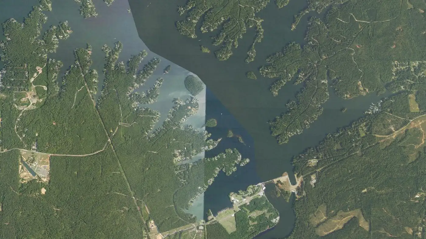
Lake Harding Fishing: Bartletts Ferry Bass, Crappie and 7 Mapped Fish Attractors
A 5,860-acre Georgia Power lake on the Chattahoochee River, right on the Alabama-Georgia line east of Opelika. Lightly fished next to West Point and Eufaula, and an Alabama license covers the whole lake.
Lake Harding, also called Bartletts Ferry, is a 5,860-acre Chattahoochee River lake on the Alabama-Georgia line east of Opelika. Alabama and Georgia licenses both work lake-wide, three public ramps serve the Alabama side, and seven fish attractor sites are GPS-mapped.
111 feet (Wikipedia; not confirmed by either state agency)
Length
N/A (not published)
Shoreline
N/A (not published)
Impounded
1926 (built by the Columbus Power Company; bought by Georgia Power in 1930)
River System
Chattahoochee River, between West Point Lake upstream and Goat Rock Lake downstream
Access
Public — Georgia Power reservoir; three public ramps on the Alabama side and two on the Georgia side
01 · Overview
The Water
Lake Harding map: hotspots, ramps and more
Numbers = fishing hotspots · R = boat ramp · C = campground · P = fishing pier · B = bait shop · M = marina. Tap a pin.
Lake Harding is the lake between the famous ones. It sits on the Chattahoochee River right on the Alabama-Georgia line east of Opelika, below West Point Lake and above Goat Rock, and Alabama's fisheries biologists say plainly that it is not as well known or as heavily fished as its neighbors. Georgia Power runs it, and most maps call it Bartletts Ferry. The state line follows the old river channel down the west side, so the Alabama water is the Lee County bank and the long Halawakee Creek arm. You do not have to think about the line: both states' licenses are recognized on all of it. Largemouth are the main bass, with spotted bass common wherever water is moving. Alabama calls the crappie fishing a fine fishery, especially in spring. Stripers, hybrids, white bass and catfish fill out the list. Docks and piers line the banks, and Georgia has sunk fish attractors at seven GPS-marked sites.
“Lake Harding holds fish in patterns you can set your watch to. The bite isn't a secret — it's what most fishermen don't know about where the grass thins onto a hard ledge.”
Alabama Fishing Atlas Editorial
Where Lake Harding sits
Shaded: county lines this water touches. Dots link to each lake guide.
County lines: U.S. Census Bureau cartographic boundaries (2023). Lake positions: Atlas lake records.
Lake Harding vs. the biggest Central Alabama lakes
Source: Atlas lake records (USACE, TVA, Alabama Power, ADCNR).
02 · Live
Today's Conditions
Major and minor solunar windows shift daily with the moon’s transit. Fish the windows above, or check the Seasonal Playbook below for Lake Harding’s current pattern.
03 · The Calendar
Seasonal Playbook
Spring is the best season on Lake Harding, and both states say so. Georgia DNR puts the peak largemouth fishing from early March through May, while the water is in the 60s, and names the baits: shallow crankbaits, plastic worms, buzzbaits, chatterbaits and spinners around boat docks, rocky points and underwater humps. Spotted bass are on rocky points in deeper water. Crappie come first, though. From early February through April they are on structure in the upper end of the lake below Riverview Dam, and Alabama's biologists call spring the best of a fine crappie fishery. The same stretch, known as Crow Hop, is the early spring spot for hybrids at normal flows and for stripers on their spawning run. Watch the marker buoys up there, because low flows make the upper lake hazardous. Bream start bedding in protected coves and tributaries in the middle of May, and red wigglers or crickets will fill a cooler.
Summer pushes fish to shade and depth. Georgia DNR's advice for largemouth is to switch to deeper crankbaits and dark-colored worms, and for spotted bass to fish the boat docks, which are thickest on the lower lake. Spots usually hold deeper than largemouth on the same cover. This is when the seven fish attractor sites earn a look with your depth finder; each one holds root wads, trophy trees and reefs. Catfishing is at its best: fish under shady docks, try the mouths of tributaries after a big rain when muddy water runs in, and fish at night in the hot months with stink bait, chicken livers or cut bait on the bottom. Stripers and hybrids roam the whole lake in summer, chasing young shad near the surface. Trolling live shad where the Halawakee Creek arm meets the main lake is the state's suggestion. Bluegill and shellcracker stay around docks, piers and brush.
Fall moves the bass fishing up the lake. Georgia DNR says to fish above Blanton Creek Park in fall, and notes that largemouth generally outnumber spotted bass in that upper stretch. Lower down, the split is close to even; recent sampling showed an equal chance of catching either. Stripers keep schooling on shad lake-wide through fall. On a windy day, fish or troll the banks the wind is blowing into, because the wind pushes baitfish against the shore and the stripers follow. Crappie have shifted by now to the lower end of the lake, around the dam and along the main channel at the mouth of the Halawakee arm, and trolling bright jigs at different depths is the quickest way to find them. Catfish stay good all year, and the Chattahoochee Valley, Halawakee Creek and dam-area ramps on the Alabama side put you close to all of it.
Winter fishing on Lake Harding is deep and slow, and it can be very good. Georgia DNR recommends deep-running plugs, jigs and shaky-head worms in dark colors for largemouth. For spotted bass, a shad-pattern crankbait or a bass jig crawled slowly over a rocky bank is the cold-water standard. Stripers stage near Bartletts Ferry Dam in winter ahead of their spring run, and hybrids hold in the same deep water; live shad, cut bait, spoons and light-colored bucktail jigs all catch them. Fish attractor site 7 sits on the Alabama bank beside the dam, a short idle from Po'Boy Landing. Catfish bite through the winter, and a water release at the dam often turns them on. Bream go deep and are hard to catch. One note for planning: Georgia Power's Blanton Creek Park ramp on the Georgia side is seasonal and closed in winter, so launch from the Alabama side.
Common in flowing water (ADCNR). Georgia DNR calls the fishery under-used: over half are 7 to 12 inches, and there is no minimum size.
Creel limit
5/day (combined)
Best season
Spring
State record
8 lbs 15 oz
#3
Crappie
Georgia DNR's 2025 sampling found fewer black crappie than average but fish 16% longer than the long-term mean, with 76% between 10 and 15 inches.
Creel limit
30/day, 9-inch min
Best season
Spring/Winter
#4
Striped Bass
Most run about 18 inches and 3 to 4 pounds; a few exceed 20 pounds. Hybrids, stocked four straight years through 2025, average about 18 inches and 2 to 3 pounds.
Creel limit
15/day (combined temperate bass)
Best season
Year-round
#5
Catfish
Georgia DNR rates catfishing good to excellent year-round: channel cats of 3 to 4 pounds, plus blues and flatheads of 10 pounds or more.
Creel limit
No statewide limit
Best season
Summer/Winter
04 · The Pattern Library
Pro Tips
Tournament pros have been decoding Lake Harding for five decades. Every tip on this card is cited to the original weigh-in recap or angler interview — no paraphrased fluff, no invented quotes.
2026 · summer
Georgia DNR fisheries biologists
2026 Fishing Forecast, Bartlett's Ferry Lake
Try trolling live shad where Halawakee Creek arm flows into the main lake.
The pattern: The mouth of the Halawakee arm is the named spot for hybrids, and for crappie later in the year.
2026 · fall
Georgia DNR fisheries biologists
2026 Fishing Forecast, Bartlett's Ferry Lake
In fall, fish further up the lake, above Georgia Power's Blanton Creek Park.
The pattern: Largemouth outnumber spots in the upper lake. Go up in fall and stay down by the docks for spots.
2026
ADCNR Wildlife & Freshwater Fisheries
Bartlett's Ferry Reservoir summary
Largemouth bass exhibit good growth and many fish reach large size because bass anglers harvest few fish.
The pattern: A lightly fished lake with room for big largemouth. The state says it is not as heavily fished as West Point or Eufaula.
05 · Hire Local
Fishing Guides
06 · Planning the Trip
Stay & Eat
Fishing Piers
Long Bridge fishing pier
Halawakee Creek arm at Long Bridge, beside the Halawakee Creek ramp (Google Maps listing: Long bridge Fishing pier, Valley, AL)
Bartletts Ferry Dam tailrace bank access
Sandy Point Recreation Area, off Lee County Road 334 (bank fishing below the dam, on Goat Rock Lake)
Camping
Blanton Creek Park (Georgia Power)
private · Hamilton, Georgia
Georgia Power campground and boat ramp on the Georgia side. Seasonal: closed in the winter months.
07 · Launch Day
On the Water
Boat ramps
concrete rampOpen
Po'Boy Landing
Salem
Parking
spots
Fee
The Alabama-side public ramp near Bartletts Ferry Dam, on Lee County Road 334. Closest launch to the dam, the lower lake and fish attractor site 7. County Road 334 also leads to Sandy Point Recreation Area, which has boat access to Goat Rock Lake and bank access to the dam tailrace.
The public ramp on the Halawakee Creek arm, which the state lists on Lee County Road 379. Google Maps lists it as Long Bridge boat ramp, with a fishing pier beside it. Fish attractor site 5 is at the bridge.
The public ramp at Chattahoochee Valley Recreation Park, off Lee County Road 380. The upper of the three Alabama ramps and the closest to the fall bass water above Blanton Creek.
Georgia Power park on the Georgia side with a boat ramp and a seasonal campground, 6111 Lickskillet Road, 706-643-7737. GPS and directions are on the Lake Harding ramp map.
10 black bass daily aggregate (largemouth / spotted / smallmouth / Alabama) — Alabama statewide limit. Shoal bass are protected from harvest in Alabama. · No statewide minimum length on black bass in Alabama general public waters. Lake Harding is reciprocal water shared with Georgia: see Alabama Regulation 220-2-.122 before keeping fish.
Crappie
30 per day (Alabama statewide). · 9-inch minimum total length (Alabama statewide). Check Regulation 220-2-.122 for the reciprocal-water rules.
Striped/White Bass
Reciprocal water with Georgia under Alabama Regulation 220-2-.122. Shoal bass are protected from harvest in Alabama. Georgia Power generating schedules and lake levels: 888-472-5253.
An Alabama or a Georgia fishing license is recognized on all waters of Lake Harding. Alabama requires a license for anglers 16 and older.. Always verify current rules before your trip.
Both. The state line runs down the west side of the lake, so the Lee County bank and the Halawakee Creek arm are Alabama and the rest is Harris County, Georgia. Alabama and Georgia fishing licenses are both recognized on the whole lake.
Alabama lists three public ramps: Chattahoochee Valley Recreation Park off Lee County Road 380, Halawakee Creek on Lee County Road 379, and near Bartletts Ferry Dam on Lee County Road 334. Georgia has two more, at Idle Hour Park and Blanton Creek Park.
Yes. Bartletts Ferry is the name of the dam and the name both state agencies use, and Lake Harding is the lake's other name, after a power company official.
Georgia DNR placed fish attractors at seven sites in April 2017 and publishes the GPS for every unit. All seven sites are mapped on this page: two on the Halawakee Creek arm, one beside the dam and four along the east side of the main lake.
Largemouth and spotted bass, black crappie, striped bass, hybrid bass, white bass, shoal bass, bream, and channel, blue and flathead catfish. Shoal bass are protected from harvest in Alabama.
Fishing regulations, water conditions, and seasonal patterns change. Alabama Fishing Atlas provides informational content only. Verify all regulations with the Alabama Department of Conservation and Natural Resources before fishing, keeping any fish, or launching watercraft. We are not liable for decisions made based on information published here. Full disclaimer →
—USDA NAIP aerial photo via USGS The National Map, checked 2026-11-10
—Georgia Power, West Georgia Lakes — https://www.georgiapower.com/our-impact/lakes-rivers/our-lakes/west-georgia-lakes.html (Georgia-side sites: Blanton Creek Park, Idle Hour Boat Ramp; checked 2026-11-12)
—Lake Harding Association business listing, Lake Harding Marina — https://lakeharding.com/businesses/lake-harding-marina/ (address, phone; checked 2026-11-12)