Coffeeville Lake Fishing: Southernmost Tombigbee Pool
USACE Mobile District 8,500-acre Tombigbee River impoundment between Demopolis Lake upstream and the Mobile-Tensaw Delta below — Coffeeville Lock & Dam operational 1960, completed 1965, navigation-first reservoir with a quiet big-catfish fishery.
Coffeeville Lake Alabama fishing covers 8,500 Tombigbee River acres in Clarke and Choctaw counties — the southernmost Central-Alabama Tombigbee pool, built 1960 by USACE with a 60-foot-high dam, worked for blue catfish, largemouth bass, and crappie on quiet navigation-system water.
1960 operational / 1965 fully completed (USACE Mobile District Coffeeville Lock & Dam)
River System
Tombigbee River
Access
Public
01 · Overview
The Water
Coffeeville Lake is the southernmost of the three Tombigbee River pools in Central-southern Alabama. The Army Corps of Engineers began construction in 1956, brought the lock and dam online in 1960, and completed the full project in 1965. The dam stands 60 feet high and impounds 8,500 acres of Tombigbee River water across Clarke and Choctaw counties. Below Coffeeville, the Tombigbee runs free toward its confluence with the Alabama River at the head of the Mobile-Tensaw Delta. Upstream sits Demopolis Lake (see /lakes/demopolis-lake). Coffeeville is a navigation-first reservoir on the Tennessee-Tombigbee Waterway — commercial barge traffic dominates the main channel, and the fishery lives in the cypress-lined oxbows and tributary arms off the navigation cut. Largemouth bass, crappie, big blue and flathead catfish, and occasional hybrid stripers all hold here. The lake is remote by Alabama standards — Coffeeville itself is a Clarke County community of around 350 people, and the nearest chain lodging is in Thomasville or Jackson.
“Coffeeville Lake holds fish in patterns you can set your watch to. The bite isn't a secret — it's what most fishermen don't know about where the grass thins onto a hard ledge.”
Alabama Fishing Atlas Editorial
Fishing Coffeeville Lake on video
Alabama's State Public Fishing Lakes Now Open — ADCNR
ADCNR
02 · Bite Windows
Solunar Forecast
Major and minor solunar windows shift daily with the moon’s transit. Fish the windows above, or check the Seasonal Playbook below for Coffeeville Lake’s current pattern.
03 · The Calendar
Seasonal Playbook
March through May is the prime window on Coffeeville. Water climbs from the upper 50s into the 70s, pre-spawn largemouth stage on oxbow mouths and Bassett Creek cypress-edge points, and a jerkbait on ten-second pauses covers the staging fish. Crappie stack on cypress stumps and brush in 6-12 feet in the tributary arms — minnows and 1/16-ounce jigs catch fish on every brush pile. Late April into May, largemouth spawn in quiet backwater oxbows on both the Clarke and Choctaw County sides. When Demopolis releases water through the upper dam, the upper Coffeeville pool fires on current-fed big blue catfish and the occasional hybrid striper — cut shad on the bottom, swimbait on the current seam. Bluegill move onto shallow flats for May full-moon spawning; cricket and red worm on cypress-edge flats catch stringers. Coffeeville's Gulf-Coast latitude means the spring bite opens a week or two earlier than Central-Alabama Tennessee River pools.
June through August Coffeeville sets up on cypress shade and the remote-lake calm. The Coffeeville Dam forebay is the headline summer destination — drift cut shad on the 30-to-60-foot channel bends for blue and flathead catfish, and the pool produces some of the biggest Tombigbee cats of the year in July. Shallow largemouth hang in the Choctaw County bayou system on cypress trunks and shaded laydowns — green-pumpkin tubes, wacky Senkos, a frog on lily mat edges. Night fishing below the dam for big flatheads on live bait is a classic Coffeeville play. Crappie slide deeper into tributary brush in 10-15 feet. First-light topwater on oxbow mouths is the bass answer before the heat builds. Barge traffic dictates the pace — stay off the navigation cut at midday, fish the oxbows and bayous in the heat.
September through November shad migrate out of the main Tombigbee into the oxbows and tributary arms, and every species follows the bait. Largemouth chase shad on cypress-edge points, laydowns, and secondary creek-mouth structure — a lipless crankbait ripped through sparse grass, a ChatterBait in shad color, a walking bait on calm mornings over Bassett Creek mouth. Crappie reload on brush and timber in 8-14 feet across the Clarke + Choctaw tributary arms. Blue cats continue on cut shad along the main channel oxbows. By mid-November the grass thins, the cooler water pushes baitfish deeper, and a slow-rolled spinnerbait becomes the late-fall largemouth answer on main-channel cypress edges. The Coffeeville Dam forebay stacks catfish and hybrid stripers on the first genuinely cold fronts in November — the southernmost Central-Alabama Tombigbee pool holds a productive bite later into the year than the upper two.
December through February Coffeeville empties out and the locals who know it work the deep water. Largemouth group on the Coffeeville Dam forebay and the deepest main-channel oxbow cypress — a suspending jerkbait on long pauses on sunny afternoons above 48°F, a hair jig vertical on the dam rock, an Alabama rig on the main-channel ledges when surface temps drop into the 40s. Crappie stack on deep brush in 15-22 feet in tributary arms. Blue and flathead catfish on cut shad along the main Tombigbee channel oxbows stay reliable all winter — the 30-to-60-foot dam forebay and channel bends produce the biggest cats of the year. Coffeeville's southern latitude (roughly 50 miles north of Mobile) means winter water holds 6-10 degrees warmer than Central-Alabama Coosa-chain pools at the same calendar date. When USACE releases water at Demopolis above or Coffeeville's gates fire, the bite turns on immediately.
12-month calendar
Tap any month to expand pattern notes. Legend: B = Bass · C = Crappie · S = Striper · Cf = Catfish.
Tournament pros have been decoding Coffeeville Lake for five decades. Every tip on this card is cited to the original weigh-in recap or angler interview — no paraphrased fluff, no invented quotes.
2025 · summer
Wikipedia — Coffeeville Lock and Dam record
Coffeeville Lock & Dam engineering fact sheet
Coffeeville Lock and Dam was constructed beginning in 1956, became operational in 1960, and was fully completed in 1965, covering an area of approximately 8,500 acres with a dam height of 60 feet and a surface area of 8,500 acres, primarily used for navigation and supporting catfish habitats.
The pattern: Coffeeville's 60-foot dam height is the deepest concentrated water point on the Central-Alabama Tombigbee system. That dam forebay holds the biggest blue catfish each year — drift cut shad on the 30-to-60-foot channel bends in July and again in December, and Coffeeville will produce trophy cats that the other three Tombigbee pools rarely match.
2023 · summer
Reed Montgomery — Reeds Guide Service (Tombigbee chain pattern)
Tombigbee chain summer ledge pattern
The July pattern on Demopolis, Aliceville and Gainesville is the same: find an old river ledge where erosion has created a 6-to-8-foot hump and where stumps still hold in the firm bottom.
The pattern: Reed's Tombigbee-chain pattern extends downstream to Coffeeville. Find the old river ledges on USACE navigation charts, crank them with a Rapala DT-6 or DT-10, Carolina-rig a 10-inch worm on a 4-foot leader, or throw a Lucky Craft Sammy walk-the-dog at first light over the stump field. Coffeeville's version of the pattern adds a deep-water advantage: the same stumps sit over 60 feet of water instead of 40.
Coffeeville Reservoir supports a strong blue and flathead catfish fishery as well as largemouth bass and crappie on the lower Tombigbee River.
The pattern: ADCNR's own profile leads with catfish. That is not coincidence — Coffeeville's depth profile, barge-trafficked channel, and cypress-oxbow geometry are exactly what Tombigbee blue cats want. Plan the trip around catfish, add bass and crappie as bonus species rather than headliners.
05 · Hire Local
Fishing Guides
On video
Fishing Coffeeville Lake on video
On the water
Alabama's State Public Fishing Lakes Now Open — ADCNR
Source: YouTube, ADCNR
06 · Planning the Trip
Stay & Eat
Where to Stay on Coffeeville Lake
Lodging near the ramps. Some links below are affiliate partnerships (Booking.com, VRBO) — they cost you nothing extra and help keep the Atlas free. Full disclosure →
Holiday Inn Express Thomasville
hotel
Thomasville, AL 36784
Closest chain hotel to Coffeeville Lake — Thomasville is ~25 minutes east. Default Coffeeville angler basecamp for traveling anglers.
Coffeeville Southern meat-and-three — plate lunches, breakfast. The only sit-down restaurant within town limits; the essential Coffeeville angler stop.
Demopolis Southern-soul restaurant ~1 hour north — a shared post-fishing option when anglers combine Demopolis and Coffeeville trips.
Nearby Attractions
Choctaw Bluff
scenic
Clarke County near Alabama River, AL 36545
Natural cliff feature on the Alabama River in Clarke County (approximate coordinates N31.36, W87.77) — a historic river landmark on the lower Alabama a short drive east of Coffeeville.
USACE Tennessee-Tombigbee Waterway visitor center — 2.5 hours north of Coffeeville but a natural add-on when traveling the full Ten-Tom system (Aliceville + Gainesville + Demopolis + Coffeeville).
Mobile-Tensaw Delta (Gulf nav section)
scenic
Mobile County, AL
The Tombigbee continues below Coffeeville Lock & Dam free-flowing to the Mobile-Tensaw Delta. The Delta is a separate /gulf/ navigation destination and is not a lake — for anglers running downriver from Coffeeville, the Delta is 60+ river miles south.
07 · Launch Day
On the Water
Boat ramps
concrete rampOpen
Coffeeville Lock & Dam Public Access
Coffeeville
Parking
spots
Fee
Free
USACE Mobile District public access at the Coffeeville Lock & Dam — primary ramp for the lower pool.
10 black bass daily aggregate (Alabama statewide) · 12-inch minimum on largemouth and smallmouth (Alabama statewide)
Crappie
30 per day · 9-inch minimum (Alabama statewide)
Striped/White Bass
Statewide temperate-bass limits apply
Coffeeville Lake is a USACE Tennessee-Tombigbee Waterway navigation pool. Follow posted no-wake zones near Coffeeville Lock & Dam. Commercial barge traffic has right-of-way — stay off the navigation channel centerline. The dam tailrace below Coffeeville has posted current and safety restrictions.
Alabama fishing license required for all anglers 16 and older (residents and non-residents). Always verify current rules before your trip.
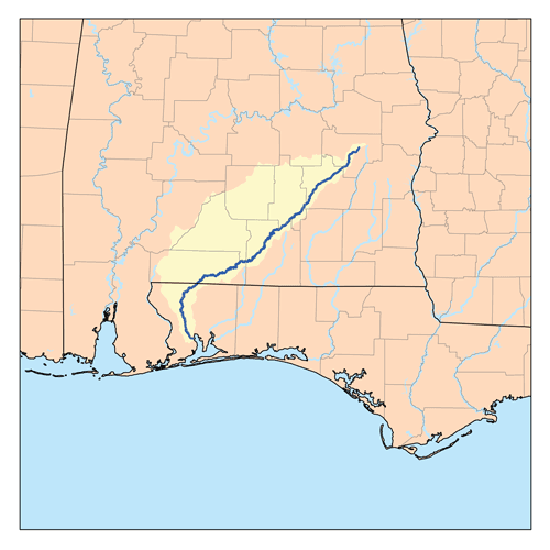
Coffeeville Lake is on the Tombigbee River in south-central Alabama, spanning Clarke County (east bank) and Choctaw County (west bank). The pool is impounded by Coffeeville Lock & Dam and is the southernmost Tombigbee River reservoir above the free-flowing stretch that runs to the Mobile-Tensaw Delta. Demopolis Lake sits upstream.
Coffeeville Lake covers 8,500 acres with a dam height of 60 feet at the Coffeeville Lock & Dam. It is roughly the same size as Aliceville Lake upstream and larger than Demopolis or Gainesville Lakes on the same Ten-Tom system.
Coffeeville Lake holds blue and flathead catfish, largemouth bass, crappie, hybrid striped bass, and bluegill. Big blue catfish are the headline — the 60-foot dam forebay and main-channel oxbow bends produce some of the largest Tombigbee cats each year. Cypress-cover tributary arms support the largemouth and crappie fisheries.
The Army Corps of Engineers began construction in 1956. The lock and dam became operational in 1960 and was fully completed in 1965 as part of the early Tennessee-Tombigbee Waterway project — Coffeeville was one of the first locks finished on the full Ten-Tom system.
Yes — all anglers 16 and older need an Alabama fishing license regardless of residency. Purchase online at ADCNR's Outdoor Alabama portal or at regional tackle shops in Thomasville, Jackson, or Grove Hill before launching.
Fishing regulations, water conditions, and seasonal patterns change. Alabama Fishing Atlas provides informational content only. Verify all regulations with the Alabama Department of Conservation and Natural Resources before fishing, keeping any fish, or launching watercraft. We are not liable for decisions made based on information published here. Full disclaimer →
Citation
Data sources
—Wikipedia — Coffeeville Lock and Dam (https://en.wikipedia.org/wiki/Coffeeville_Lock_and_Dam): 60 ft dam, 8,500-acre pool, 1956-1965 construction
—coffeeville.uslakes.info — Coffeeville Lock & Dam fact sheet (https://coffeeville.uslakes.info/dam.asp)
—USACE Mobile District — Tennessee-Tombigbee Waterway (https://www.sam.usace.army.mil/Missions/Civil-Works/Recreation/Tennessee-Tombigbee-Waterway-Tenn-Tom/)