Written by Atlas Editorial · Last updated
Lake Oliver is a 2,150-acre Georgia Power lake on the Chattahoochee River between Goat Rock Dam and Oliver Dam at Columbus, Georgia. Alabama is the west bank. Public launching is limited to one city-owned marina.
Lake Oliver today
Measured readings, not a bite prediction. Where each number comes from · All Alabama lakes today
- Acreage
- 2,150 acres
- Max Depth
- 50 feet
- Length
- N/A (not published); the lake runs from Goat Rock Dam down to Oliver Dam
- Shoreline
- 40 miles
- Impounded
- 1959, when Georgia Power finished Oliver Dam
- River System
- Georgia Power, West Georgia Lakes Resources Office, 706-322-0228
- Access
- Public launching is limited to one marina owned by the City of Columbus; most of the shoreline is private
The Water
Lake Oliver map: hotspots, ramps and more
Numbers = fishing hotspots · R = boat ramp · C = campground · P = fishing pier · B = bait shop · M = marina. Tap a pin.
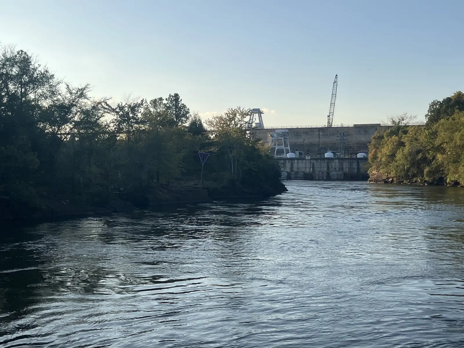
Lake Oliver is the bottom lake of three that Georgia Power stacked on the Chattahoochee above Columbus: Harding, Goat Rock, then Oliver. Oliver Dam was finished in 1959. It stands 70 feet tall and 2,150 feet long and holds 2,150 acres of water with 40 miles of shoreline and a deepest point of 50 feet. The lake is wide at the south end by the dam and narrows as you run north, until it is nearly a river at the foot of Goat Rock Dam. Alabama's Lee County is the west bank and Columbus, Georgia, is the east. Both sides are heavily built up, so most of the shoreline is private, and public launching comes down to one place: the marina owned by the City of Columbus. The lake is also the city's water supply. Summer brings heavy boat traffic. No agency publishes a regular fishing report for Oliver that we can cite, so the spots here are landmarks, not promises.
“Lake Oliver holds fish in patterns you can set your watch to. The bite isn't a secret — it's what most fishermen don't know about where the grass thins onto a hard ledge.”
Alabama Fishing Atlas Editorial
Today's Conditions
Major and minor solunar windows shift daily with the moon’s transit. Fish the windows above, or check the Seasonal Playbook below for Lake Oliver’s current pattern.
Seasonal Playbook
No agency publishes a spring fishing report for Lake Oliver that we can cite, so this section sticks to what the published description of the lake and the map support. Outside the summer boating season, the lake is described as a place where anglers usually fish for sunfish. The lake is wide at the south end by Oliver Dam and narrows steadily toward Goat Rock Dam, where it is almost a river. The one public launch is the city marina on the Georgia bank near the dam, so every trip starts at the lower end. Standing Boy Creek comes in on the Georgia side and is the clearest creek mouth on the map. Most of the bank is private on both sides, so plan to fish from the boat. Alabama's statewide limits are 10 black bass a day and 30 crappie a day with a 9-inch minimum. Read the reciprocal-water rule before keeping fish.
No agency publishes a summer fishing report for Lake Oliver that we can cite. What is published is a warning of a different kind: in summer the lake is very crowded with recreational boats, because it sits inside the Columbus city limits with houses on both banks. If you fish it in summer, go early or late in the day and expect wakes. The lake reaches 50 feet at its deepest and is widest near Oliver Dam. Upstream it narrows to river width below Goat Rock Dam, and the current there follows what Georgia Power releases. Launching is at the city marina on the Georgia bank, the one public launch on the lake. The banks are mostly private, so stay in the boat and off the docks. Stay out of the marked areas at both dams. Carry the license that covers the bank you fish, because the Georgia line runs along this water.
No agency publishes a fall fishing report for Lake Oliver that we can cite, so this is the published description of the lake and not a catch report. Once the summer boat traffic drops off, the lake is described as a place where anglers usually fish for sunfish. The city marina near Oliver Dam is the one public launch. From there the lake runs north past the mouth of Standing Boy Creek on the Georgia side and narrows until it reaches the foot of Goat Rock Dam. Both banks are built up and mostly private, so treat the shoreline as off limits unless it is signed public. Alabama's statewide limits are 10 black bass a day and 30 crappie a day with a 9-inch minimum length. This is border water with Georgia, so read the reciprocal-water rule and carry the right license. Georgia Power's lake office answers at 706-322-0228.
No agency publishes a winter fishing report for Lake Oliver that we can cite, so this section sticks to access and rules. The lake covers 2,150 acres with 40 miles of shoreline and is 50 feet at its deepest. Georgia Power finished Oliver Dam in 1959 and still runs it, along with Goat Rock Dam at the top of the lake. Its West Georgia Lakes office answers at 706-322-0228. Winter is the quiet season for boat traffic, and the published description of the lake says anglers outside summer usually fish for sunfish. The one public launch is the marina owned by the City of Columbus, on the Georgia bank near the dam. Alabama's statewide crappie limit is 30 a day with a 9-inch minimum, and the black bass limit is 10 a day. Read the reciprocal-water rule before keeping fish, because Alabama is one bank and Georgia is the other.
Species on this water
Bluegill
The published description of the lake says anglers here usually fish for sunfish outside the busy summer season.
- Creel limit
- No statewide limit
- Best season
- Spring/Summer
Largemouth Bass
We have not confirmed a species list from an agency page for this lake, so bass are listed without a claim about numbers or size.
- Creel limit
- 5/day (combined)
- Best season
- Spring
- State record
- 16 lbs 8 oz
Fishing Guides
Stay & Eat
On the Water
Boat ramps
Lake Oliver Marina
Columbus, GA
- Parking
- spots
- Fee
- City of Columbus marina; call ahead for launch fees
The one public launch on the lake, on the Georgia bank near Oliver Dam.
Directions➤ Map of all 1 boat ramps on Lake Oliver
Bait shops near the lake
Regulations
Regulations on Lake Oliver
- Bass (combined)
- 10 black bass daily aggregate — Alabama statewide limit. This is border water with Georgia: see Alabama Regulation 220-2-.122. · No statewide minimum length for largemouth bass in Alabama; check Regulation 220-2-.122 and Georgia's rules before keeping fish on this border water.
- Crappie
- 30 per day (Alabama statewide). · 9-inch minimum total length (Alabama statewide); check Regulation 220-2-.122 for the reciprocal-water rules.
- Striped/White Bass
Oliver Dam and Goat Rock Dam belong to Georgia Power, 706-322-0228. Stay out of the marked restricted areas at both dams. Most of the shoreline is private property.
The Alabama-Georgia line runs along this lake. Carry the license for the bank you launch and fish from, and read the reciprocal-water rule (Alabama Regulation 220-2-.122) before fishing the far bank.. Always verify current rules before your trip.
Full Alabama fishing regulations ›Nearby Waters
Goat Rock Lake
About 940 acres
Largemouth Bass
Lake Harding
5,860 acres (ADCNR); Georgia DNR lists 5,850
Largemouth Bass · Spotted Bass
West Point Lake
25,864 acres (ADCNR); Georgia DNR lists 25,900
Spotted Bass · Largemouth Bass
Lake Eufaula
45,181 acres
Largemouth Bass · Crappie
Lake Oliver questions
Fishing regulations, water conditions, and seasonal patterns change. Alabama Fishing Atlas provides informational content only. Verify all regulations with the Alabama Department of Conservation and Natural Resources before fishing, keeping any fish, or launching watercraft. We are not liable for decisions made based on information published here. Full disclaimer →
Data sources
- Wikipedia, Lake Oliver — https://en.wikipedia.org/wiki/Lake_Oliver (2,150 acres, 50-foot maximum depth, 40 miles of shoreline, Oliver Dam completed 1959 by Georgia Power, one public marina; checked 2026-11-12)
- Georgia Power, West Georgia Lakes — https://www.georgiapower.com/our-impact/lakes-rivers/our-lakes/west-georgia-lakes.html (lake office and phone; checked 2026-11-12)
- OpenStreetMap contributors — https://www.openstreetmap.org (marina, dam, creek and park positions; read 2026-11-12)
- Alabama statewide creel and size limits as already cited on the Atlas West Point Lake page (Alabama Regulation 220-2-.122 covers reciprocal waters with Georgia)
Data last reviewed: 2026-11-12