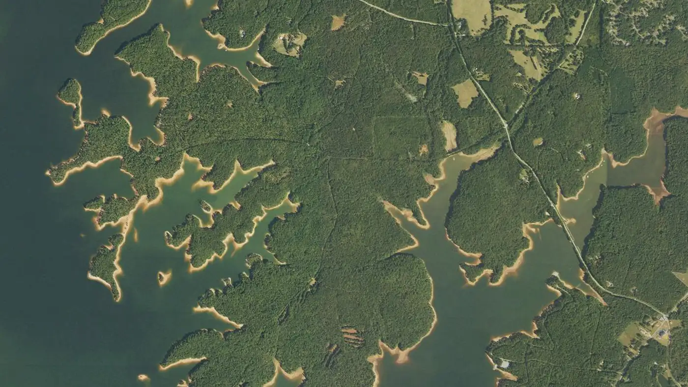
West Point Lake Fishing: Alabama Side Ramps, Spotted Bass and Wehadkee Creek Crappie
A 25,864-acre Corps of Engineers lake on the Chattahoochee River at Lanett. Most of the water is in Georgia, but an Alabama license covers nearly all of it.
West Point Lake is a 25,864-acre Corps of Engineers reservoir on the Alabama-Georgia line at Lanett. Alabama license holders may fish everywhere except above the Highway 109 bridge on the Chattahoochee arm. Spotted bass are abundant and largemouth run big.
Chattahoochee River, upstream of Lake Harding (Bartletts Ferry)
Access
Public — U.S. Army Corps of Engineers lake (706-645-2937) with Corps parks, ramps and campgrounds on both the Alabama and Georgia sides
01 · Overview
The Water
West Point Lake map: hotspots, ramps and more
Numbers = fishing hotspots · R = boat ramp · C = campground · P = fishing pier · B = bait shop · M = marina. Tap a pin.
West Point Lake is mostly a Georgia lake that Alabama anglers get to fish as their own. The Corps of Engineers dam sits on the Chattahoochee River at the state line just north of Interstate 85, and the west side of the lower lake, with Veasey, Stroud and Wehadkee creeks, runs up into Chambers and Randolph counties. Alabama's fisheries agency spells out the deal: an Alabama license is good anywhere on the lake except the Chattahoochee River arm above the Highway 109 bridge. The same agency describes a fairly deep, rocky lake, 23 feet on average, with little cover on the bottom apart from rocky points and humps, so any spot with sunken wood gathers fish. Spotted bass of one to three pounds are abundant. Largemouth are fewer and bigger; of 105 the state collected in spring 2012, eight topped five pounds and the best weighed 8.5. Crappie, hybrids, stripers and catfish round it out.
“West Point Lake holds fish in patterns you can set your watch to. The bite isn't a secret — it's what most fishermen don't know about where the grass thins onto a hard ledge.”
Alabama Fishing Atlas Editorial
Where West Point Lake sits
Shaded: county lines this water touches. Dots link to each lake guide.
County lines: U.S. Census Bureau cartographic boundaries (2023). Lake positions: Atlas lake records.
West Point Lake vs. the biggest Central Alabama lakes
Source: Atlas lake records (USACE, TVA, Alabama Power, ADCNR).
02 · Live
Today's Conditions
Major and minor solunar windows shift daily with the moon’s transit. Fish the windows above, or check the Seasonal Playbook below for West Point Lake’s current pattern.
03 · The Calendar
Seasonal Playbook
Spring starts in the creeks. Georgia DNR's crappie advice for early spring is to troll bright-colored jigs in the upper portions of Beech, Whitewater, Wehadkee and Stroud creeks, and two of those, Wehadkee and Stroud, are on the Alabama side of the lake. Alabama's own angler survey found most successful crappie fishermen in the Wehadkee Creek section. Bass follow the same warmth. Start with shallow-running crankbaits and spinnerbaits in protected coves and on sunny, rocky banks, and work spotted bass in the deeper creek mouths. Hybrids and stripers run up the Chattahoochee toward the shoals at Franklin in spring, but that water is above the Highway 109 bridge, where an Alabama license is not valid, so leave it to Georgia license holders. Catfishing is also at its best up that arm in spring. Bream go on the bed around the May full moon, close to Mother's Day, and live worms or crickets under a float are all you need.
Summer bass fishing moves out to the channels. Georgia DNR says to fish deep-running crankbaits and plastic worms on main creek and river channel structure, and to look under the tree canopy near the upper ends of the major creek arms. Largemouth stay close to fallen trees and logs in warm weather, and hundreds of shoreline trees have been toppled around the lake in recent years to give them cover. Spotted bass hold on structure along the channels, on rocky points and in blowdowns, with more of them in the clearer lower lake. Crappie go deep and gather around bridges; fishing at night with lights is popular because the fish move shallower after dark. Catfish bite best at night around bridges and other structure. Hybrids handle the warm water well and school along the main river and tributary channels, where slow-trolling a live shad of four to six inches is the standard approach. Bream fishing is best early in the morning.
Fall on West Point is about covering water. Georgia DNR's tip for finding feeding bass is to move fast with a buzzbait in chartreuse or white, and it works on both largemouth and the more numerous spotted bass. Spots are quick to hit and rarely big: most are under 12 inches and few pass 16, and both states want anglers to keep a limit of the small ones. Riprap along the bridges holds spotted bass and largemouth all year and is worth a stop every trip. When rain stains the main lake, Georgia DNR says to fish the Wehadkee Creek arm, and the Dewberry ramp is the upper launch on the Alabama side. Watch for surface commotion over the channels, since hybrids give themselves away when they push schools of shad to the top. Bank anglers have two public fishing piers on the lake, at the McGee Bridge and Rocky Point access areas. Call the Corps office at 706-645-2937 for park hours.
Winter fishing is deep and close to the channel. For largemouth, Georgia DNR lists deep-diving crankbaits, chatterbaits, jigs, shaky-head worms and drop-shot flukes worked in brush piles, on rock ledges and on points near the main channel. Spotted bass sit deep on river-channel structure and rock; a shaky-head worm or a drop-shot rig over a brush pile is the cool-weather choice. On a warm afternoon, move up and fish sunny banks with rock on them. Hybrids suspend deep in the river channel. Stripers spread through the main lake in winter, especially near the dam, and in late winter they school in the main river channel before the spring run. Crappie hold around and just above anything vertical, such as bridge pilings. The lake has little natural cover on the bottom, so the ten fish attractor sites Georgia has marked by GPS are worth checking with your electronics this time of year.
Species on this water
#1
Spotted Bass
ADCNR: spots of one to three pounds are abundant and made up more than 80% of the bass anglers kept in 2012. Both states encourage keeping smaller spotted bass.
Black crappie. Georgia DNR calls them abundant, with 10-inch fish common; ADCNR's 2012 survey found most successful crappie anglers in the Wehadkee Creek section.
Creel limit
30/day, 9-inch min
Best season
Spring/Winter
#4
Striped Bass
Hybrids are stocked regularly and run 2 to 4 pounds; Gulf striped bass over 30 pounds are in the lake (Georgia DNR).
Creel limit
15/day (combined temperate bass)
Best season
Year-round
#5
Catfish
Georgia DNR: channel catfish are by far the most abundant, with 48% between 16 and 24 inches; blues and flatheads over 10 pounds are showing up more often.
Creel limit
No statewide limit
Best season
Summer/Winter
04 · The Pattern Library
Pro Tips
Tournament pros have been decoding West Point Lake for five decades. Every tip on this card is cited to the original weigh-in recap or angler interview — no paraphrased fluff, no invented quotes.
2012
ADCNR Wildlife & Freshwater Fisheries
West Point Reservoir summary
any site with underwater woody debris tends to concentrate fish, especially largemouth bass
The pattern: On a rocky lake with little cover, find wood: toppled shoreline trees, brush piles and the marked fish attractors.
2026
Georgia DNR fisheries biologists
2026 Fishing Forecast, West Point Lake
Fish Wehadkee Creek arm when the rest of the lake is stained.
The pattern: Wehadkee is the arm that runs up into Alabama. Head there after heavy rain.
2026
Georgia DNR fisheries biologists
2026 Fishing Forecast, West Point Lake
Focus on riprap along bridges, which usually hold spots year-round.
The pattern: Bridge riprap is the one pattern that works in every season here.
05 · Hire Local
Fishing Guides
06 · Planning the Trip
Stay & Eat
Fishing Piers
McGee Bridge Access fishing pier
McGee Bridge Recreation Area, Troup County, Georgia (Corps of Engineers)
Rocky Point Access fishing pier
Rocky Point access area (Corps of Engineers); call 706-645-2937 for directions
Camping
Amity Campground
coe · Lanett
Corps of Engineers campground on the Alabama side of the lower lake. Reservations and season dates through the Corps (706-645-2937).
R. Shaefer Heard Campground
coe · West Point, GA
Corps of Engineers campground on the Georgia side beside West Point Dam. Reservations through Recreation.gov.
Corps day-use fee (reported as $5 per vehicle in 2021)
Corps of Engineers park and boat launch on the Alabama side in Chambers County, with picnic shelters. Closest launch to Veasey Creek and Stroud Creek. The Corps collected a $5 per vehicle launch and day-use fee by card in 2021; confirm the current fee at 706-645-2937.
Corps day-use fee (reported as $5 per vehicle in 2021)
Corps of Engineers ramp near Five Points in Chambers County. The upper Alabama-side launch, toward Wehadkee Creek, where the state's survey found the best crappie fishing. Confirm fee and status with the Corps at 706-645-2937.
10 black bass daily aggregate — Alabama statewide limit. West Point is reciprocal water with special rules: see Alabama Regulation 220-2-.122. · Georgia DNR lists a 14-inch minimum size on largemouth bass at West Point Lake and no length limit on spotted bass. Check Alabama Regulation 220-2-.122 before keeping fish.
Crappie
30 per day (Alabama statewide). · 9-inch minimum total length (Alabama statewide); check Regulation 220-2-.122 for the reciprocal-water rules.
Striped/White Bass
Reciprocal water with Georgia; special regulations apply (Alabama Regulation 220-2-.122). The dam, parks, ramps and campgrounds are run by the U.S. Army Corps of Engineers, 706-645-2937.
Alabama license holders may fish anywhere on West Point Lake except upstream of the Highway 109 bridge on the Chattahoochee River arm, where a Georgia license is required.. Always verify current rules before your trip.
Yes, almost all of it. Alabama's fisheries agency says Alabama license holders may fish anywhere on the lake except the part of the Chattahoochee River arm upstream of the Highway 109 bridge.
The Corps of Engineers has launches at Veasey Creek Recreation Area and Dewberry Recreation Area, both in Chambers County. Call the Corps at 706-645-2937 for current fees and closures.
Yes. Alabama's 2012 angler survey found anglers catching more than eight bass for every ten hours fished, with abundant spotted bass of one to three pounds and largemouth over eight pounds in state sampling. Georgia DNR says the lake consistently produces quality bass fishing.
Alabama's survey found most successful crappie anglers in the Wehadkee Creek section. Georgia DNR adds the upper portions of Beech, Whitewater and Stroud creeks in early spring, and bridges at night in summer.
25,864 acres by Alabama's figure, with a mean depth of 23 feet. It is an Army Corps of Engineers reservoir on the Chattahoochee River, about an hour southwest of Atlanta.
Fishing regulations, water conditions, and seasonal patterns change. Alabama Fishing Atlas provides informational content only. Verify all regulations with the Alabama Department of Conservation and Natural Resources before fishing, keeping any fish, or launching watercraft. We are not liable for decisions made based on information published here. Full disclaimer →
Citation
Data sources
—ADCNR Wildlife & Freshwater Fisheries, West Point Reservoir page — https://www.outdooralabama.com/reservoirs/west-point-reservoir (acreage, license rule, 2012 survey and sampling; checked 2026-11-11)
—Georgia DNR Wildlife Resources Division, 'Fishing Forecast - West Point Lake' (2026) — https://storymaps.arcgis.com/stories/a019d774757344c5adfc91a3dd5f73db
—Georgia DNR fish attractor GPS dataset for West Point Lake — http://georgiawildlife.com/sites/default/files/wrd/WestPoint_FishAttractors.zip
—LaGrange Daily News, 'West Point Lake resumes fee collections' (2021; $5 per vehicle launch and day-use fee) — https://www.lagrangenews.com/?p=84730
—U.S. Army Corps of Engineers, West Point Lake recreation — https://www.sam.usace.army.mil/Missions/Civil-Works/Recreation/West-Point-Lake/
—OpenStreetMap / Nominatim, checked 2026-11-11 (dam, Veasey Creek and Dewberry recreation areas)
—Google Maps business listings via Outscraper (Amity Campground; checked 2026-11-10)
—USDA NAIP aerial photo via USGS The National Map, checked 2026-11-11
—Recreation.gov, West Point Lake (U.S. Army Corps of Engineers) — https://www.recreation.gov (Georgia-side Corps parks and campgrounds; checked 2026-11-12)
—OpenStreetMap contributors — https://www.openstreetmap.org (ramp positions on the ramp map; read 2026-11-12)