Written by Atlas Editorial · Last updated
Lake Seminole is a 37,500-acre Corps of Engineers reservoir at the corner of Florida, Georgia and Alabama, where the Chattahoochee and Flint rivers join. About 80 percent is in Georgia, and Georgia limits apply on most of it.
Lake Seminole today
Measured readings, not a bite prediction. Where each number comes from · All Alabama lakes today
- Acreage
- 37,500 acres
- Max Depth
- 30 feet
- Length
- 35 miles
- Shoreline
- 376 miles
- Impounded
- Formed by Jim Woodruff Lock and Dam near Chattahoochee, Florida
- River System
- U.S. Army Corps of Engineers
- Access
- Public — Corps of Engineers parks, Florida and Georgia state parks, and county landings on both shores
The Water
Lake Seminole map: hotspots, ramps and more
Numbers = fishing hotspots · R = boat ramp · C = campground · P = fishing pier · B = bait shop · M = marina. Tap a pin.
Lake Seminole is the bottom of the Chattahoochee chain. The Chattahoochee comes down the Alabama line, the Flint comes in from Georgia, and the two meet behind Jim Woodruff Lock and Dam near Chattahoochee, Florida. What leaves the dam is the Apalachicola River. The lake covers 37,500 acres with 376 miles of shoreline, and it is shallow: about 10 feet on average and 30 at the deepest. Florida's wildlife agency puts about 80 percent of the water in Georgia, so Georgia's limits apply on most of the lake and your license decides where you can fish. The agency lists Florida largemouth bass, bluegill, redear sunfish, black crappie, striped bass and sunshine bass. Its standing advice: topwater on the flats early, lizards, worms or crankbaits by mid-morning, deeper water in the afternoon. Nobody publishes a regular dated report we can cite, so the spots on this page are access points, not promises.
“Lake Seminole holds fish in patterns you can set your watch to. The bite isn't a secret — it's what most fishermen don't know about where the grass thins onto a hard ledge.”
Alabama Fishing Atlas Editorial
Today's Conditions
Major and minor solunar windows shift daily with the moon’s transit. Fish the windows above, or check the Seasonal Playbook below for Lake Seminole’s current pattern.
Seasonal Playbook
No dated spring report is published for Lake Seminole that we can cite, so what follows is the standing advice from Florida's wildlife agency and not a catch report. Florida bass use the flats early in the day and take topwater there. By mid-morning the agency says to switch to lizards, worms or crankbaits, and by afternoon to move to deeper water. On the Chattahoochee River arm, bass concentrate in the channels between the small islands, and Parramore Landing on the Florida side puts you on that arm. Bluegill and redear sunfish are both on the lake's species list, with a combined panfish limit of 50. The bass limit is 10 a day, each 12 inches or longer, under the Georgia rules that cover most of the lake. Carry the right license for the side you plan to fish, because about 80 percent of the water is in Georgia.
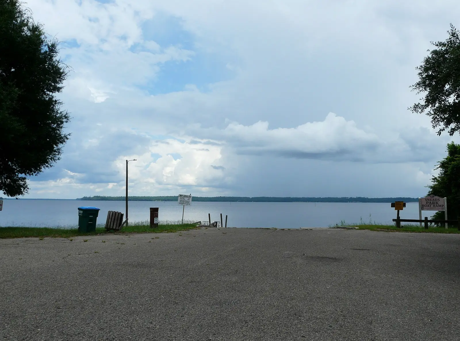
The agency's daily pattern matters most in the heat: fish the flats with topwater at first light, change to lizards, worms or crankbaits by mid-morning, and move to deeper water in the afternoon. Striped bass and sunshine bass school in the lower lake near Indian Mounds and along the old river channels that run to Jim Woodruff Lock and Dam. Chattahoochee Park, Sneads Park and Three Rivers State Park are the mapped ramps closest to that lower end. The limit on striped, white and sunshine bass is 15 in total, with no more than two of them 22 inches or longer. Lake Seminole averages about 10 feet deep, so run the marked channels and expect shallow water away from them. No dated summer report is published for the lake that we can cite, so treat this as the agency's general guidance and not a promise.
Florida's wildlife agency calls fall one of the best times to fish Lake Seminole, because cooler water gets gamefish feeding. The daily routine it gives still applies: flats and topwater early, then lizards, worms or crankbaits, then deeper water in the afternoon. On the Chattahoochee River arm, the agency says bass concentrate in the channels between the small islands. Striped bass and sunshine bass school in the lower lake near Indian Mounds and along the old river channels to the dam. The Flint River arm has Corps of Engineers ramps at Hales Landing and Faceville Landing, and the Georgia shore has Seminole State Park. The bass limit is 10 a day at 12 inches or longer on most of the lake. No dated fall report is published that we can cite, so this is the agency's standing advice and not a catch report from this season.
No winter report is published for Lake Seminole that we can cite, so this section sticks to what the state agency and the map can support. Black crappie are on the agency's species list, and the limit is 30 a day. Striped bass and sunshine bass are listed too, with a limit of 15 in total and no more than two of them 22 inches or longer. The agency places those schooling fish in the lower lake near Indian Mounds and along the old river channels toward Jim Woodruff Lock and Dam. Lake Seminole is 35 miles long and averages about 10 feet deep, so plan a short run from the nearest ramp and stay in the marked channels. Sixteen public ramps are mapped on this page, on the Florida and Georgia shores. No more than 50 fish in total may be kept, whatever the species.
Species on this water
Largemouth Bass
Florida bass on the flats early, deeper by afternoon, per Florida's wildlife agency. Bass on the Chattahoochee arm hold in channels between the small islands.
- Creel limit
- 5/day (combined)
- Best season
- Spring
- State record
- 16 lbs 8 oz
Striped Bass
Striped and sunshine bass school in the lower lake near Indian Mounds and along the old river channels to the dam.
- Creel limit
- 15/day (combined temperate bass)
- Best season
- Year-round
Crappie
Black crappie are on the agency's species list; the daily limit is 30.
- Creel limit
- 30/day, 9-inch min
- Best season
- Spring/Winter
Bluegill
Bluegill and redear sunfish are both listed by the agency; the panfish limit is 50.
- Creel limit
- No statewide limit
- Best season
- Spring/Summer
Fishing Guides
Stay & Eat
On the Water
Boat ramps
Three Rivers State Park Boat Ramp
Sneads, FL
- Parking
- spots
- Fee
- Florida state park entry fee
Florida state park on the west shore of the lower lake, with camping beside the ramp.
DirectionsSeminole State Park Boat Ramp
Seminole County, GA
- Parking
- spots
- Fee
- Georgia state park parking fee
Georgia state park on the lake.
DirectionsHales Landing Boat Ramp
Decatur County, GA
- Parking
- spots
- Fee
- Corps of Engineers day-use pass (Recreation.gov)
Corps park on the Flint River arm.
DirectionsParramore Landing Boat Ramp
Jackson County, FL
- Parking
- spots
- Fee
Chattahoochee River arm, Florida side.
Directions➤ Map of all 16 boat ramps on Lake Seminole
Bait shops near the lake
Regulations
Regulations on Lake Seminole
- Bass (combined)
- 10 black bass per day (Georgia limits, which Florida's wildlife agency says apply on the lake). · Each bass must be 12 inches or longer in total length. West of Highway 271, Florida's statewide bass rules apply instead.
- Crappie
- 30 crappie per day. · No minimum length for crappie is listed for the lake by Florida's wildlife agency.
- Striped/White Bass
Striped, white and sunshine bass: 15 total, no more than two of them 22 inches or longer. Panfish other than crappie: 50. Pickerel: 15. No more than 50 fish in total, whatever the species.
About 80 percent of the lake is in Georgia. By agreement, a Florida license covers you south and west of a line the two states set; beyond it you need a Georgia license. Check the line on the agency's page before you cross the lake.. Always verify current rules before your trip.
Full Alabama fishing regulations ›Nearby Waters
Lake Seminole questions
Fishing regulations, water conditions, and seasonal patterns change. Alabama Fishing Atlas provides informational content only. Verify all regulations with the Alabama Department of Conservation and Natural Resources before fishing, keeping any fish, or launching watercraft. We are not liable for decisions made based on information published here. Full disclaimer →
Data sources
- Florida Fish and Wildlife Conservation Commission, Lake Seminole — https://myfwc.com/fishing/freshwater/sites-forecasts/nw/lake-seminole/ (size, species, limits, license line, fishing notes; checked 2026-11-12)
- Wikipedia, Lake Seminole — https://en.wikipedia.org/wiki/Lake_Seminole (acreage, shoreline, depth, rivers, Jim Woodruff Lock and Dam; checked 2026-11-12)
- Recreation.gov, Lake Seminole (U.S. Army Corps of Engineers) — https://www.recreation.gov (Corps park names and positions; checked 2026-11-12)
- OpenStreetMap contributors — https://www.openstreetmap.org (ramp and park positions; read 2026-11-12)
Data last reviewed: 2026-11-12