Written by Atlas Editorial · Last updated
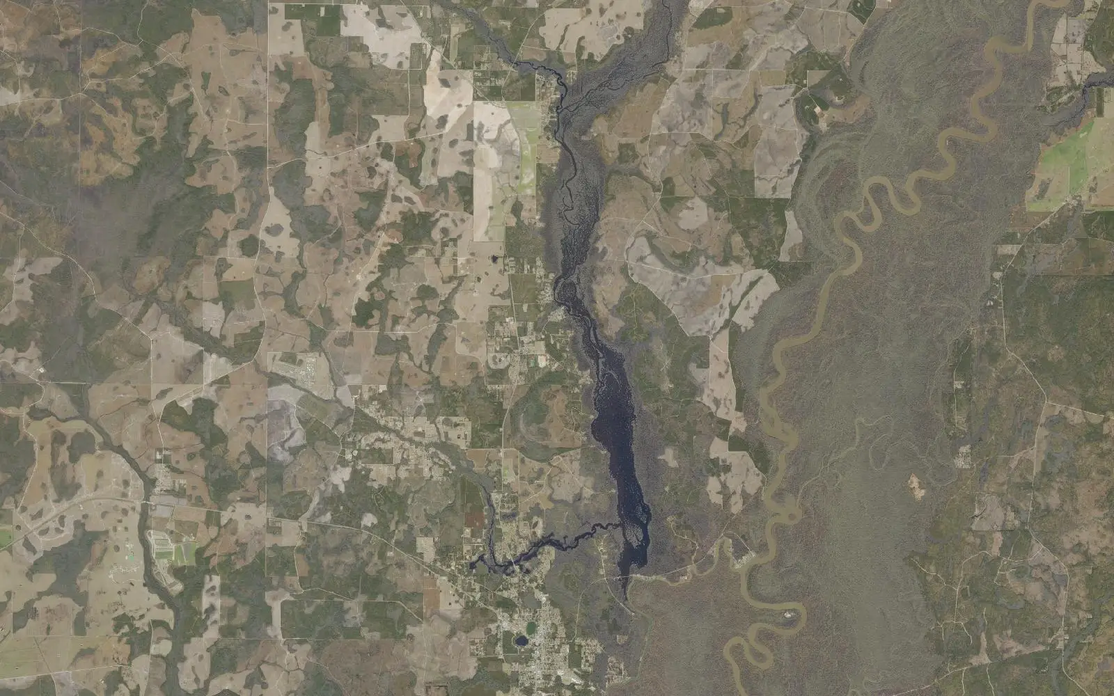
Dead Lake is a 6,700-acre lake of dark tannic water on the Chipola River near Wewahitchka, Florida. The state says it has an excellent reputation for bluegill and shellcracker in spring. It is full of cypress stumps.
Dead Lake today
Measured readings, not a bite prediction. Where each number comes from · All Alabama lakes today
- Acreage
- 6,700 acres
- Max Depth
- N/A (not published by the state)
- Length
- N/A (not published by the state)
- Shoreline
- N/A (not published by the state)
- Impounded
- A wide, cypress-filled stretch of the Chipola River near Wewahitchka
- River System
- Public water; ramps run by Gulf County and Calhoun County
- Access
- Public — two county ramps, one private pay ramp, and fish camps around the lake
The Water
Dead Lake map: hotspots, ramps and more
Numbers = fishing hotspots · R = boat ramp · C = campground · P = fishing pier · B = bait shop · M = marina. Tap a pin.
Dead Lake is 6,700 acres of dark, tannic water on the Chipola River near Wewahitchka, in Calhoun and Gulf counties. Florida's wildlife agency calls it strangely beautiful, and warns in the same breath that it is filled with cypress snags and stumps, so take care running a motor. For anglers new to the lake it recommends using a GPS or keeping to West Arm Creek, which you reach from the Dead Lake recreation area off State Road 71 just north of Wewahitchka. A second ramp in Calhoun County reaches the northwestern part of the lake through Cypress Creek and has no facilities. The lake has an excellent reputation for bluegill and redear sunfish in the spring, the agency says, and there are fish camps around the shore. Three launch sites are mapped on this page with GPS. Nobody publishes a regular dated report we can cite, so the spots here are access points, not promises.
“Dead Lake holds fish in patterns you can set your watch to. The bite isn't a secret — it's what most fishermen don't know about where the grass thins onto a hard ledge.”
Alabama Fishing Atlas Editorial
Today's Conditions
Major and minor solunar windows shift daily with the moon’s transit. Fish the windows above, or check the Seasonal Playbook below for Dead Lake’s current pattern.
Seasonal Playbook
Spring is bream season on Dead Lake. Florida's wildlife agency says the lake enjoys an excellent reputation for its bluegill and redear sunfish, the shellcracker, at this time of year. Its method is specific: a wiggler on an ultra-light rod with a number 10 gold hook, or a beetlespin, fished around stumps and snags, along weed lines and in deep holes. Those same stumps are the hazard. The agency says the lake is filled with cypress snags and that navigating them can be difficult for new anglers, so it recommends a GPS or limiting your fishing to West Arm Creek. The Dead Lake recreation area off State Road 71, just north of Wewahitchka, has the ramp for that arm. Yellow perch are on the agency's species list for the lake as well. No dated spring report is published that we can cite, so treat this as the agency's standing advice and not a catch report from this year.
No dated summer report is published for Dead Lake that we can cite, and the state agency gives no summer pattern of its own, so this section keeps to its standing advice. Bream: a wiggler on an ultra-light rod with a number 10 gold hook, or a beetlespin, around stumps and snags, along weed lines and in deep holes. Catfish are the other option the agency raises. Flathead catfish can be caught in deep flowing areas and behind large snags using sunfish for bait, and the agency asks anglers to keep every flathead because the fish is not native here. Live sunfish may only be used as bait if you caught them yourself on hook and line. Channel catfish and suckers are in the lake too, and sucker nets are not allowed. Run slowly: the lake is filled with cypress stumps, and the agency suggests a GPS or staying in West Arm Creek.
Fall is when the bass turn on at Dead Lake. Florida's wildlife agency says Florida bass fishing picks up in the fall as the fish move out of the deep holes and feed in shallow water. It recommends fishing around dusk and dawn in two to three feet of water with worms, lizards or live shiners. Bream are still there for the taking with a wiggler on a number 10 gold hook or a beetlespin, worked around stumps, snags, weed lines and deep holes. Flathead catfish hold in deep flowing areas and behind large snags; the agency asks anglers to keep them because they are not native. The usual warning applies: the lake is full of cypress stumps and snags, and the agency tells new anglers to use a GPS or keep to West Arm Creek. No dated fall report is published for the lake that we can cite, so this is standing advice and not this season's catch.
Florida's wildlife agency gives no winter pattern for Dead Lake, and no dated winter report is published that we can cite, so this section sticks to what the agency and the map support. The agency says bass move out of the deep holes to feed shallow in the fall; it does not say where they go in winter. Bream are fished in deep holes as well as around stumps, with a wiggler on a number 10 gold hook or a beetlespin. Three launch sites are mapped on this page. Dead Lakes County Park is a Gulf County ramp on Stone Mill Creek with no launch fee listed. Nadine Stone Landing is the Calhoun County ramp on Cypress Creek, which reaches the northwestern part of the lake. Beards and Cox Landing is a private pay ramp near Wewahitchka. The lake is filled with cypress stumps and snags, so go slowly, and carry a GPS as the agency suggests.
Species on this water
Bluegill
Bluegill and shellcracker are the lake's reputation, best in spring. A wiggler on a number 10 gold hook or a beetlespin around stumps, snags, weed lines and deep holes.
- Creel limit
- No statewide limit
- Best season
- Spring/Summer
Largemouth Bass
Picks up in the fall as bass leave the deep holes. Dusk and dawn in 2 to 3 feet of water with worms, lizards or live shiners.
- Creel limit
- 5/day (combined)
- Best season
- Spring
- State record
- 16 lbs 8 oz
Catfish
Flathead catfish hold in deep flowing areas and behind large snags. The state asks anglers to keep them; they are not native here.
- Creel limit
- No statewide limit
- Best season
- Summer/Winter
Fishing Guides
Stay & Eat
On the Water
Boat ramps
Dead Lakes County Park
Wewahitchka, FL
- Parking
- spots
- Fee
Gulf County ramp on Stone Mill Creek, one launch lane, no launch fee listed in the state inventory.
DirectionsNadine Stone Landing Public Boat Ramp
Wewahitchka, FL
- Parking
- spots
- Fee
Calhoun County ramp on Cypress Creek, one launch lane. Reaches the northwestern part of the lake.
DirectionsBeards / Cox Landing
Wewahitchka, FL
- Parking
- spots
- Fee
- Pay ramp (private)
Private pay ramp, one launch lane.
Directions➤ Map of all 3 boat ramps on Dead Lake
Bait shops near the lake
Regulations
Regulations on Dead Lake
- Bass (combined)
- 5 black bass per day under Florida's statewide rule. · No statewide minimum length for largemouth bass; only 1 of the 5 may be 16 inches or longer.
- Crappie
- No minimum or special daily number for crappie is given on the state's Dead Lake page; Florida's statewide freshwater bag limit applies. · No minimum length for crappie is given on the state's Dead Lake page.
- Striped/White Bass
Sucker nets are not allowed. Live sunfish may be used as bait only if you caught them on hook and line. Bass follow the statewide rule: 5 a day, only 1 of them 16 inches or longer.
A Florida freshwater fishing license. The whole water is in Florida, in Calhoun and Gulf counties.. Always verify current rules before your trip.
Full Alabama fishing regulations ›Nearby Waters
Dead Lake questions
Fishing regulations, water conditions, and seasonal patterns change. Alabama Fishing Atlas provides informational content only. Verify all regulations with the Alabama Department of Conservation and Natural Resources before fishing, keeping any fish, or launching watercraft. We are not liable for decisions made based on information published here. Full disclaimer →
Data sources
- Florida Fish and Wildlife Conservation Commission, Dead Lake — https://myfwc.com/fishing/freshwater/sites-forecasts/nw/dead-lake/ (size, location, stump warning, species, fishing notes, contacts; checked 2026-11-12)
- Florida Fish and Wildlife Conservation Commission, Florida Boat Ramp Inventory — https://gis.myfwc.com (ramp names, positions, lanes, fees, managers; retrieved 2026-11-12)
- Florida Fish and Wildlife Conservation Commission, Northwest Region Fishing Forecasts — https://myfwc.com/fishing/freshwater/sites-forecasts/nw/ (list of state-managed fishing sites in the region; checked 2026-11-12)
Data last reviewed: 2026-11-12