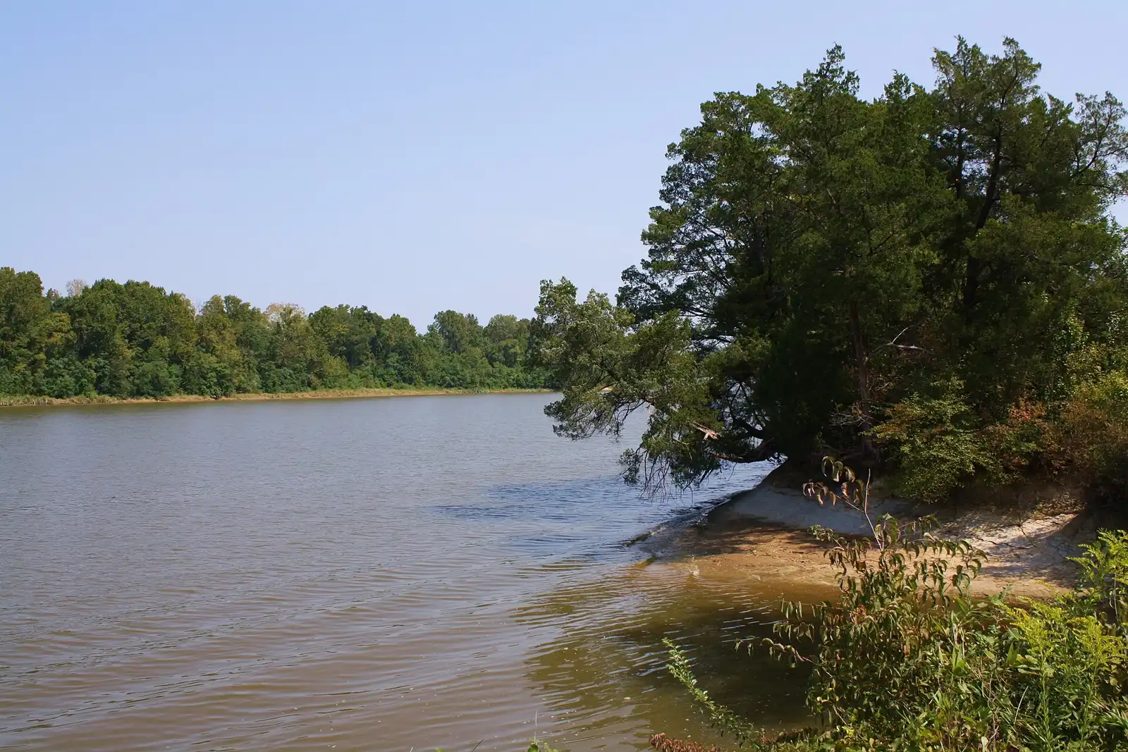
Adventures Perdido River (Call Ahead 850-968-5529)
Perdido River · Cantonment, FL
Freshwater · Hand launch only · Fee
30.60546, -87.39817
➤ DirectionsPerdido River · Cantonment, FL
Freshwater · Hand launch only · Fee
30.60546, -87.39817
➤ DirectionsPensacola Bay - Bayou Texar · Pensacola, FL
Salt or brackish · 4-lane ramp · Fee
30.42633, -87.18626
➤ DirectionsPensacola Bay - Bayou Texar · Pensacola, FL
Salt or brackish · 2-lane ramp · Fee
30.43265, -87.18824
➤ DirectionsPensacola Bay - Bayou Texar · Pensacola, FL
Salt or brackish · Hand launch only · No fee
30.43241, -87.18881
➤ DirectionsEscambia River · Cantonment, FL
Freshwater · 1-lane ramp
30.62614, -87.26558
➤ DirectionsEscambia River · Cantonment, FL
Freshwater · 1-lane ramp · Fee
30.62322, -87.26791
➤ DirectionsBig Lagoon · Pensacola, FL
Salt or brackish · 2-lane ramp · Fee
30.31181, -87.42186
➤ DirectionsBig Lagoon · Pensacola, FL
Salt or brackish · Hand launch only · Fee
30.30998, -87.40300
➤ DirectionsPensacola Bay - Bayou Grande · Pensacola, FL
Salt or brackish · 1-lane ramp · No fee
30.36340, -87.33624
➤ DirectionsEscambia River · Century, FL
Freshwater · 1-lane ramp
30.92698, -87.28660
➤ DirectionsEscambia River · Century, FL
Freshwater · Hand launch only · No fee
30.93425, -87.26954
➤ DirectionsBluff Springs Lake · Century, FL
Freshwater · Hand launch only · No fee
30.93414, -87.27903
➤ DirectionsBluff Springs Lake · Century, FL
Freshwater · Hand launch only · No fee
30.93664, -87.27465
➤ DirectionsRock Bluff Lake · Century, FL
Freshwater · Hand launch only · No fee
30.93506, -87.27268
➤ DirectionsBluff Springs Lake · Century, FL
Freshwater · Hand launch only · No fee
30.93614, -87.27268
➤ DirectionsBluff Springs Lake · Century, FL
Freshwater · Hand launch only · No fee
30.93554, -87.27096
➤ DirectionsEscambia River · Mc David, FL
Freshwater · 1-lane ramp · No fee
30.84043, -87.31252
➤ DirectionsPensacola Bay · Pensacola, FL
Salt or brackish · Hand launch only
30.40449, -87.22251
➤ DirectionsPensacola Bay · Pensacola, FL
Salt or brackish · 2-lane ramp · Fee
30.41963, -87.19369
➤ DirectionsPensacola Bay - Bayou Grande - Davenport Bayou · Pensacola, FL
Salt or brackish · Hand launch only · No fee
30.38218, -87.27463
➤ DirectionsPerdido Bay · Pensacola, FL
Salt or brackish · Hand launch only · No fee
30.31732, -87.44777
➤ DirectionsEscambia River · Mc David, FL
Freshwater · 1-lane ramp · No fee
30.78467, -87.31413
➤ DirectionsPerdido River · Molino, FL
Freshwater · Hand launch only · No fee
30.67503, -87.40594
➤ DirectionsPerdido Bay - Old River · Pensacola, FL
Salt or brackish · 2-lane ramp · No fee
30.31388, -87.44202
➤ DirectionsPerdido Bay - Bayou Garcon · Pensacola, FL
Salt or brackish · Hand launch only · No fee
30.32094, -87.44208
➤ DirectionsBig Lagoon · Pensacola, FL
Salt or brackish · 1-lane ramp · Fee
30.30286, -87.41474
➤ DirectionsPerdido Bay - Old River · Pensacola, FL
Salt or brackish · Hand launch only · No fee
30.31391, -87.44314
➤ DirectionsPensacola Bay - Bayou Chico · Pensacola, FL
Salt or brackish · Hand launch only · No fee
30.40289, -87.26758
➤ DirectionsLake Stone · Century, FL
Freshwater · 1-lane ramp · No fee
30.96762, -87.29238
➤ DirectionsEscambia River · Mc David, FL
Freshwater · 1-lane ramp · No fee
30.87728, -87.31306
➤ DirectionsPensacola Bay - Bayou Chico · Pensacola, FL
Salt or brackish · 5-lane ramp
30.39976, -87.24728
➤ DirectionsPerdido Bay · Pensacola, FL
Salt or brackish · Hand launch only · No fee
30.42176, -87.34891
➤ DirectionsPerdido Bay - Heron Bayou · Pensacola, FL
Salt or brackish · 1-lane ramp · No fee
30.40258, -87.37452
➤ DirectionsEscambia River · Molino, FL
Freshwater · 2-lane ramp · No fee
30.72374, -87.30603
➤ DirectionsEscambia River · Mc David, FL
Freshwater · 1-lane ramp · No fee
30.85521, -87.31166
➤ DirectionsPensacola Bay - Bayou Grande · Pensacola, FL
Salt or brackish · 4-lane ramp · No fee
30.38078, -87.28212
➤ DirectionsPerdido River · Cantonment, FL
Freshwater · Hand launch only · No fee
30.66676, -87.40429
➤ DirectionsSanta Rosa Sound · Gulf Breeze, FL
Salt or brackish · Hand launch only · No fee
30.32642, -87.18100
➤ DirectionsPerdido Bay · Pensacola, FL
Salt or brackish · 2-lane ramp · No fee
30.40837, -87.37405
➤ DirectionsPerdido Bay - Old River · Pensacola, FL
Salt or brackish · Hand launch only · No fee
30.30719, -87.44129
➤ DirectionsPerdido River · Pensacola, FL
Freshwater · 1-lane ramp · No fee
30.52376, -87.44294
➤ DirectionsSalters Lake · Century, FL
Freshwater · Hand launch only · No fee
30.94708, -87.26435
➤ DirectionsPerdido River · Pensacola, FL
Freshwater · 1-lane ramp · No fee
30.53763, -87.43993
➤ DirectionsPensacola Bay - Bayou Chico · Pensacola, FL
Salt or brackish · 2-lane ramp · Fee
30.40008, -87.23781
➤ DirectionsEscambia River · Pensacola, FL
Salt or brackish · 2-lane ramp · Fee
30.54694, -87.19478
➤ DirectionsEscambia River · Pensacola, FL
Salt or brackish · 3-lane ramp · Fee
30.54700, -87.19636
➤ DirectionsPerdido River · Cantonment, FL
Freshwater · Hand launch only · No fee
30.63056, -87.39312
➤ DirectionsPensacola Bay / Bayou Grande · Pensacola, FL
Salt or brackish · Hand launch only · No fee
30.36575, -87.33030
➤ DirectionsPerdido River · Pensacola, FL
Freshwater · 2-lane ramp · No fee
30.52321, -87.44517
➤ DirectionsPerdido River · Pensacola, FL
Freshwater · Hand launch only · No fee
30.52317, -87.44369
➤ DirectionsColdwater Creek · Milton, FL
Freshwater · Hand launch only · Fee
30.76043, -86.99526
➤ DirectionsPensacola Bay - Escambia Bay - Mulatto Bayou · Milton, FL
Salt or brackish · 4-lane ramp · No fee
30.53469, -87.12286
➤ DirectionsPensacola Bay - Escambia Bay - Mulatto Bayou · Milton, FL
Salt or brackish · Hand launch only · No fee
30.53510, -87.12265
➤ DirectionsPensacola Bay - Escambia Bay - Mulatto Bayou · Milton, FL
Salt or brackish · 1-lane ramp · No fee
30.54871, -87.10502
➤ DirectionsPensacola Bay - Escambia Bay - Mulatto Bayou · Milton, FL
Salt or brackish · 1-lane ramp · No fee
30.54543, -87.09280
➤ DirectionsBlackwater River · Milton, FL
Salt or brackish · Hand launch only · No fee
30.60296, -87.03014
➤ DirectionsBlackwater River · Milton, FL
Salt or brackish · 1-lane ramp · No fee
30.59642, -87.02880
➤ DirectionsPensacola Bay - East Bay · Gulf Breeze, FL
Salt or brackish · 1-lane ramp · No fee
30.39779, -87.04836
➤ DirectionsBig Juniper Creek · Milton, FL
Freshwater · Hand launch only · No fee
30.72719, -86.89966
➤ DirectionsBig Juniper Creek · Milton, FL
Freshwater · Hand launch only · No fee
30.83116, -86.90338
➤ DirectionsBig Juniper Creek · Milton, FL
Freshwater · Hand launch only · No fee
30.78534, -86.89133
➤ DirectionsColdwater Creek · Milton, FL
Freshwater · Hand launch only · No fee
30.88233, -86.95891
➤ DirectionsColdwater Creek · Milton, FL
Freshwater · Hand launch only · No fee
30.84651, -86.98390
➤ DirectionsSweetwater Creek · Milton, FL
Freshwater · Hand launch only · No fee
30.83861, -86.87083
➤ DirectionsBlackwater River · Holt, FL
Freshwater · 1-lane ramp · No fee
30.71079, -86.86624
➤ DirectionsBlackwater River · Holt, FL
Freshwater · Hand launch only · Fee
30.70396, -86.88135
➤ DirectionsPensacola Bay - East Bay - Blackwater Bay · Milton, FL
Salt or brackish · 1-lane ramp · No fee
30.55747, -86.98289
➤ DirectionsBlackwater River · Milton, FL
Salt or brackish · 1-lane ramp · No fee
30.63365, -87.03587
➤ DirectionsBlackwater River · Milton, FL
Salt or brackish · 2-lane ramp · No fee
30.63223, -87.03764
➤ DirectionsEscambia River · Jay, FL
Freshwater · 1-lane ramp · No fee
30.82947, -87.29768
➤ DirectionsColdwater Creek · Milton, FL
Freshwater · Hand launch only · No fee
30.74298, -86.98420
➤ DirectionsColdwater Creek · Milton, FL
Freshwater · 1-lane ramp · No fee
30.70871, -86.97213
➤ DirectionsPensacola Bay - East Bay · Milton, FL
Salt or brackish · 2-lane ramp · No fee
30.48090, -87.05835
➤ DirectionsPensacola Bay - East Bay - East Bay River · Navarre, FL
Salt or brackish · 2-lane ramp · No fee
30.44125, -86.86671
➤ DirectionsAtwell Pond · Eglin Afb, FL
Freshwater · Hand launch only
30.56123, -86.87343
➤ DirectionsYellow River · Eglin Afb, FL
Freshwater · Hand launch only · Fee
30.57878, -86.90026
➤ DirectionsYellow River - Boiling Creek · Eglin Afb, FL
Freshwater · Hand launch only · Fee
30.56506, -86.86858
➤ DirectionsYellow River · Eglin Afb, FL
Freshwater · Hand launch only · Fee
30.60862, -86.83718
➤ DirectionsYellow River · Eglin Afb, FL
Salt or brackish · Hand launch only
30.55330, -86.93936
➤ DirectionsPensacola Bay - East Bay - Blackwater Bay · Eglin Afb, FL
Salt or brackish · Hand launch only · No fee
30.51656, -87.00728
➤ DirectionsPensacola Bay - East Bay - Blackwater Bay · Eglin Afb, FL
Salt or brackish · Hand launch only · No fee
30.50981, -87.00343
➤ DirectionsYellow River · Milton, FL
Freshwater · 1-lane ramp · No fee
30.63043, -86.81194
➤ DirectionsPensacola Bay - Escambia Bay · Milton, FL
Salt or brackish · 2-lane ramp · No fee
30.58106, -87.16154
➤ DirectionsPensacola Bay - Escambia Bay · Milton, FL
Salt or brackish · 1-lane ramp · No fee
30.44471, -87.10167
➤ DirectionsSanta Rosa Sound · Gulf Breeze, FL
Salt or brackish · 4-lane ramp · Fee
30.35146, -87.17454
➤ DirectionsPensacola Bay · Gulf Breeze, FL
Salt or brackish · 1-lane ramp · Fee
30.37253, -87.17746
➤ DirectionsPensacola Bay - East Bay - East Bay River · Navarre, FL
Salt or brackish · 1-lane ramp · No fee
30.44906, -86.91577
➤ DirectionsPensacola Bay - Escambia Bay - Indian Bayou · Milton, FL
Salt or brackish · 1-lane ramp · No fee
30.52403, -87.09290
➤ DirectionsPensacola Bay - Escambia Bay · Milton, FL
Salt or brackish · 2-lane ramp · Fee
30.57518, -87.18395
➤ DirectionsEscambia River · Jay, FL
Freshwater · 1-lane ramp · No fee
30.75990, -87.29063
➤ DirectionsPensacola Bay - East Bay - Blackwater Bay · Milton, FL
Salt or brackish · 1-lane ramp · No fee
30.58098, -86.98864
➤ DirectionsBlackwater River - Marquis Basin · Milton, FL
Salt or brackish · 2-lane ramp · No fee
30.62271, -87.02411
➤ DirectionsPensacola Bay - East Bay - Blackwater Bay · Milton, FL
Salt or brackish · 1-lane ramp · Fee
30.56400, -87.01136
➤ DirectionsBlackwater River · Milton, FL
Salt or brackish · 1-lane ramp · No fee
30.60644, -87.02346
➤ DirectionsSanta Rosa Sound · Gulf Breeze, FL
Salt or brackish · Hand launch only · No fee
30.38530, -87.01350
➤ DirectionsSanta Rosa Sound · Navarre, FL
Salt or brackish · 2-lane ramp · No fee
30.38343, -86.86328
➤ DirectionsBlackwater River · Milton, FL
Salt or brackish · 2-lane ramp · No fee
30.60209, -87.02905
➤ DirectionsYellow River · Milton, FL
Freshwater · 1-lane ramp · No fee
30.61996, -86.83349
➤ DirectionsEscambia River - Quintette Lake · Milton, FL
Freshwater · 1-lane ramp · No fee
30.67001, -87.26622
➤ DirectionsBlackwater River · Milton, FL
Salt or brackish · 2-lane ramp · No fee
30.62717, -87.03318
➤ DirectionsBlackwater River · Milton, FL
Salt or brackish · Hand launch only · No fee
30.63074, -87.02952
➤ DirectionsPensacola Bay - Escambia Bay · Milton, FL
Salt or brackish · Hand launch only · No fee
30.57899, -87.18207
➤ DirectionsPensacola Bay - East Bay - Blackwater Bay · Milton, FL
Salt or brackish · 1-lane ramp · No fee
30.58391, -86.99726
➤ DirectionsEscambia River · Jay, FL
Freshwater · 1-lane ramp · No fee
30.97576, -87.18898
➤ DirectionsEscambia River · Milton, FL
Freshwater · 1-lane ramp · No fee
30.73246, -87.28498
➤ DirectionsEscambia River - Williams Lake · Jay, FL
Freshwater · 1-lane ramp · No fee
30.87784, -87.29218
➤ DirectionsSanta Rosa Sound · Gulf Breeze, FL
Salt or brackish · 1-lane ramp · No fee
30.38736, -86.99678
➤ DirectionsShoal River · Crestview, FL
Freshwater · 2-lane ramp
30.69732, -86.57116
➤ DirectionsBlackwater River · Baker, FL
Freshwater · Hand launch only · No fee
30.83418, -86.73382
➤ DirectionsBlackwater River · Baker, FL
Freshwater · 1-lane ramp · No fee
30.80161, -86.76687
➤ DirectionsBlackwater River · Holt, FL
Freshwater · 1-lane ramp · No fee
30.72393, -86.79172
➤ DirectionsBlackwater River · Baker, FL
Freshwater · Hand launch only · No fee
30.98912, -86.72040
➤ DirectionsHurricane Lake · Baker, FL
Freshwater · 1-lane ramp · Fee
30.94317, -86.75504
➤ DirectionsHurricane Lake · Baker, FL
Freshwater · 1-lane ramp · Fee
30.93724, -86.75261
➤ DirectionsKarick Lake · Baker, FL
Freshwater · 1-lane ramp · Fee
30.89591, -86.64228
➤ DirectionsKarick Lake · Baker, FL
Freshwater · 1-lane ramp · Fee
30.89376, -86.64345
➤ DirectionsBlackwater River · Baker, FL
Freshwater · Hand launch only · No fee
30.93327, -86.73592
➤ DirectionsChoctawhatchee Bay · Destin, FL
Salt or brackish · 1-lane ramp · Fee
30.39699, -86.51547
➤ DirectionsAnderson Pond · Eglin Afb, FL
Freshwater · Hand launch only
30.56000, -86.51470
➤ DirectionsYellow River · Eglin Afb, FL
Freshwater · Hand launch only · Fee
30.67343, -86.69797
➤ DirectionsDuck Pond · Eglin Afb, FL
Freshwater · Boat ramp
30.67133, -86.63440
➤ DirectionsEast Bay River (Eglin AFB) · Eglin Afb, FL
Freshwater · Hand launch only · Fee
30.43163, -86.77214
➤ DirectionsYellow River · Eglin Afb, FL
Freshwater · 1-lane ramp · Fee
30.68024, -86.65096
➤ DirectionsJR Walton Pond · Eglin Afb, FL
Freshwater · Hand launch only
30.69536, -86.47162
➤ DirectionsYellow River · Eglin Afb, FL
Freshwater · 1-lane ramp · Fee
30.66880, -86.72851
➤ DirectionsMetts Pond · Eglin Afb, FL
Freshwater · Hand launch only
30.62540, -86.72535
➤ DirectionsRoberts Lake · Eglin Afb, FL
Freshwater · Hand launch only
30.53476, -86.46784
➤ DirectionsTiti Creek -(Eglin AFB) · Eglin Afb, FL
Freshwater · Hand launch only · Fee
30.70008, -86.46832
➤ DirectionsTurkey Creek (Eglin AFB) · Eglin Afb, FL
Freshwater · Hand launch only · Fee
30.58118, -86.57491
➤ DirectionsTurkey Creek (Eglin AFB) · Eglin Afb, FL
Freshwater · Hand launch only · Fee
30.57969, -86.60734
➤ DirectionsTurkey Creek (Eglin AFB) · Eglin Afb, FL
Freshwater · Hand launch only · Fee
30.56174, -86.53646
➤ DirectionsChoctawhatchee Bay · Niceville, FL
Salt or brackish · Hand launch only · Fee
30.45204, -86.42136
➤ DirectionsChoctawhatchee Bay - Rocky Bayou · Niceville, FL
Salt or brackish · 2-lane ramp · Fee
30.50147, -86.43743
➤ DirectionsChoctawhatchee Bay - Rocky Bayou · Niceville, FL
Salt or brackish · Hand launch only · Fee
30.50069, -86.43063
➤ DirectionsChoctawhatchee Bay · Fort Walton Beach, FL
Salt or brackish · 1-lane ramp · No fee
30.42939, -86.60049
➤ DirectionsYellow River · Holt, FL
Freshwater · 1-lane ramp · No fee
30.66068, -86.76517
➤ DirectionsChoctawhatchee Bay - Joe's Bayou · Destin, FL
Salt or brackish · 5-lane ramp · Fee
30.41051, -86.49120
➤ DirectionsChoctawhatchee Bay - Boggy Bayou · Valparaiso, FL
Salt or brackish · 2-lane ramp
30.50756, -86.48766
➤ DirectionsSanta Rosa Sound · Fort Walton Beach, FL
Salt or brackish · 2-lane ramp · Fee
30.40587, -86.63814
➤ DirectionsChoctawhatchee Bay - Garnier Bayou · Shalimar, FL
Salt or brackish · 1-lane ramp · No fee
30.45558, -86.58737
➤ DirectionsChoctawhatchee Bay · Shalimar, FL
Salt or brackish · 1-lane ramp · No fee
30.43339, -86.57484
➤ DirectionsYellow River · Crestview, FL
Freshwater · 1-lane ramp · No fee
30.74843, -86.62530
➤ DirectionsSanta Rosa Sound · Mary Esther, FL
Salt or brackish · 1-lane ramp · Fee
30.40696, -86.65052
➤ DirectionsChoctawhatchee Bay - Boggy Bayou · Niceville, FL
Salt or brackish · 2-lane ramp · No fee
30.51089, -86.48091
➤ DirectionsYellow River · Laurel Hill, FL
Freshwater · 1-lane ramp · No fee
30.92533, -86.55890
➤ DirectionsChoctawhatchee Bay - Cinco Bayou · Fort Walton Beach, FL
Salt or brackish · 1-lane ramp · No fee
30.43170, -86.62183
➤ DirectionsShoal River · Crestview, FL
Freshwater · 2-lane ramp · No fee
30.75343, -86.50969
➤ DirectionsYellow River · Baker, FL
Freshwater · 1-lane ramp · No fee
30.87013, -86.59180
➤ DirectionsChoctawhatchee Bay - Don's Bayou · Fort Walton Beach, FL
Salt or brackish · 1-lane ramp · No fee
30.44847, -86.60110
➤ DirectionsYellow River · Holt, FL
Freshwater · 1-lane ramp · Fee
30.67429, -86.74703
➤ DirectionsChoctawhatchee Bay · Fort Walton Beach, FL
Salt or brackish · 3-lane ramp · No fee
30.40013, -86.59252
➤ DirectionsChoctawhatchee Bay · Fort Walton Beach, FL
Salt or brackish · Hand launch only · No fee
30.40070, -86.59500
➤ DirectionsChoctawhatchee Bay - Cinco Bayou · Fort Walton Beach, FL
Salt or brackish · 2-lane ramp · Fee
30.42511, -86.60935
➤ DirectionsChoctawhatchee Bay - Rocky Bayou · Niceville, FL
Salt or brackish · 1-lane ramp
30.51005, -86.45545
➤ DirectionsTurkey Creek (Okaloosa County) · Niceville, FL
Freshwater · Hand launch only · No fee
30.53149, -86.50620
➤ DirectionsChoctawhatchee Bay - Boggy Bayou · Valparaiso, FL
Salt or brackish · 1-lane ramp · No fee
30.51815, -86.49831
➤ DirectionsChoctawhatchee Bay - Boggy Bayou · Valparaiso, FL
Salt or brackish · 1-lane ramp
30.49674, -86.48740
➤ DirectionsChoctawhatchee Bay - Cinco Bayou · Fort Walton Beach, FL
Salt or brackish · 1-lane ramp · No fee
30.43117, -86.63675
➤ DirectionsChoctawhatchee Bay - Alaqua Creek · Freeport, FL
Salt or brackish · 1-lane ramp · No fee
30.51242, -86.18666
➤ DirectionsChoctawhatchee River · Ponce De Leon, FL
Freshwater · 1-lane ramp · No fee
30.69385, -85.86622
➤ DirectionsChoctawhatchee River - Berry Ann (Berrian) Lake · Ponce De Leon, FL
Freshwater · 1-lane ramp · No fee
30.70066, -85.86112
➤ DirectionsChoctawhatchee River - Black Creek · Freeport, FL
Freshwater · 1-lane ramp · No fee
30.45076, -86.06811
➤ DirectionsChoctawhatchee River - Black Creek · Freeport, FL
Freshwater · 1-lane ramp · Fee
30.43716, -86.10953
➤ DirectionsChoctawhatchee River · Ponce De Leon, FL
Freshwater · 1-lane ramp · No fee
30.45123, -85.89903
➤ DirectionsChoctawhatchee River - Bruce Creek · Ponce De Leon, FL
Freshwater · 1-lane ramp · No fee
30.62142, -85.92453
➤ DirectionsJuniper Lake · Defuniak Springs, FL
Freshwater · 1-lane ramp · No fee
30.77388, -86.13323
➤ DirectionsChoctawhatchee River · Ponce De Leon, FL
Freshwater · 1-lane ramp · Fee
30.67978, -85.87621
➤ DirectionsChoctawhatchee Bay - Hogtown Bayou · Santa Rosa Beach, FL
Salt or brackish · 2-lane ramp · No fee
30.39871, -86.22899
➤ DirectionsChoctawhatchee Bay · Freeport, FL
Salt or brackish · 1-lane ramp · No fee
30.47685, -86.33086
➤ DirectionsChoctawhatchee River · Ponce De Leon, FL
Freshwater · 1-lane ramp · No fee
30.61995, -85.91063
➤ DirectionsChoctawhatchee River - Cow Lake · Ponce De Leon, FL
Freshwater · 1-lane ramp · No fee
30.67523, -85.87938
➤ DirectionsChoctawhatchee River · Ponce De Leon, FL
Freshwater · 1-lane ramp · No fee
30.45057, -85.89929
➤ DirectionsChoctawhatchee River · Ponce De Leon, FL
Freshwater · 1-lane ramp · No fee
30.54198, -85.89045
➤ DirectionsEastern Lake · Santa Rosa Beach, FL
Freshwater · 1-lane ramp · No fee
30.30938, -86.08967
➤ DirectionsChoctawhatchee Bay - Tucker Bayou · Santa Rosa Beach, FL
Salt or brackish · Hand launch only · Fee
30.37368, -86.11917
➤ DirectionsChoctawhatchee Bay - Basin Bayou · Freeport, FL
Freshwater · Hand launch only · Fee
30.49694, -86.24017
➤ DirectionsBasin Creek (Eglin AFB) · Freeport, FL
Freshwater · Hand launch only · Fee
30.51733, -86.23574
➤ DirectionsChoctawhatchee Bay · Freeport, FL
Salt or brackish · Hand launch only · Fee
30.48351, -86.26641
➤ DirectionsIndigo Pond · Defuniak Springs, FL
Freshwater · Hand launch only
30.69747, -86.33163
➤ DirectionsRocky Creek (Eglin AFB) · Defuniak Springs, FL
Freshwater · Hand launch only · Fee
30.57296, -86.36657
➤ DirectionsRocky Creek (Eglin AFB) · Defuniak Springs, FL
Freshwater · Hand launch only · Fee
30.53508, -86.38228
➤ DirectionsSpec Pond · Defuniak Springs, FL
Freshwater · Hand launch only
30.69793, -86.38909
➤ DirectionsChoctawhatchee Bay · Freeport, FL
Salt or brackish · Hand launch only · No fee
30.43222, -86.15421
➤ DirectionsChoctawhatchee Bay · Freeport, FL
Salt or brackish · 2-lane ramp · No fee
30.43246, -86.15449
➤ DirectionsWestern Lake · Santa Rosa Beach, FL
Freshwater · 1-lane ramp · No fee
30.32993, -86.16364
➤ DirectionsChoctawhatchee Bay - LaGrange Bayou - Four Mile Creek · Freeport, FL
Salt or brackish · Hand launch only · No fee
30.50158, -86.14581
➤ DirectionsChoctawhatchee Bay · Fort Walton Beach, FL
Salt or brackish · Hand launch only
30.40441, -86.59294
➤ DirectionsJuniper Lake · Defuniak Springs, FL
Freshwater · 1-lane ramp · No fee
30.76224, -86.12570
➤ DirectionsLake Jackson (Walton County) · Laurel Hill, FL
Freshwater · 1-lane ramp · No fee
30.99188, -86.33326
➤ DirectionsLake Stanley · Defuniak Springs, FL
Freshwater · 1-lane ramp · No fee
30.73579, -86.13907
➤ DirectionsChoctawhatchee Bay · Miramar Beach, FL
Salt or brackish · 1-lane ramp · No fee
30.38692, -86.35878
➤ DirectionsChoctawhatchee Bay - LaGrange Bayou - Four Mile Creek · Freeport, FL
Salt or brackish · 1-lane ramp · No fee
30.48635, -86.13661
➤ DirectionsChoctawhatchee River - Morrison Springs · Ponce De Leon, FL
Freshwater · 1-lane ramp · No fee
30.65673, -85.90306
➤ DirectionsChoctawhatchee Bay - Basin Bayou · Freeport, FL
Salt or brackish · 1-lane ramp · No fee
30.48680, -86.25095
➤ DirectionsChoctawhatchee Bay · Santa Rosa Beach, FL
Salt or brackish · 1-lane ramp · No fee
30.41939, -86.22791
➤ DirectionsChoctawhatchee Bay - Tucker Bayou · Santa Rosa Beach, FL
Salt or brackish · 1-lane ramp · No fee
30.37273, -86.11490
➤ DirectionsChoctawhatchee Bay - Alaqua Creek · Freeport, FL
Salt or brackish · 1-lane ramp · No fee
30.50733, -86.19370
➤ DirectionsSeven Runs Creek · Ponce De Leon, FL
Freshwater · Hand launch only · No fee
30.53938, -85.92043
➤ DirectionsChoctawhatchee River · Vernon, FL
Freshwater · 1-lane ramp
30.37638, -86.02321
➤ DirectionsChoctawhatchee Bay · Santa Rosa Beach, FL
Salt or brackish · 4-lane ramp · No fee
30.39777, -86.16950
➤ DirectionsChoctawhatchee River - Lost Lake · Ponce De Leon, FL
Freshwater · 1-lane ramp · No fee
30.56034, -85.89698
➤ DirectionsCampbell Lake · Santa Rosa Beach, FL
Freshwater · Hand launch only · Fee
30.36816, -86.29109
➤ DirectionsChoctawhatchee River · Bonifay, FL
Freshwater · 1-lane ramp · No fee
30.81490, -85.83908
➤ DirectionsChoctawhatchee River · Westville, FL
Freshwater · 1-lane ramp · No fee
30.83546, -85.87854
➤ DirectionsChoctawhatchee River · Bonifay, FL
Freshwater · 1-lane ramp · No fee
30.80235, -85.82847
➤ DirectionsChoctawhatchee River · Bonifay, FL
Freshwater · 1-lane ramp · No fee
30.91857, -85.85173
➤ DirectionsChoctawhatchee River · Bonifay, FL
Freshwater · 1-lane ramp · No fee
30.94754, -85.84298
➤ DirectionsLake Victor · Westville, FL
Freshwater · 1-lane ramp · No fee
30.95052, -85.89200
➤ DirectionsChoctawhatchee River · Westville, FL
Freshwater · 1-lane ramp · No fee
30.89055, -85.88190
➤ DirectionsChoctawhatchee River - Hardwood Lake -Wrights Creek · Bonifay, FL
Freshwater · Boat ramp · No fee
30.79561, -85.82315
➤ DirectionsChoctawhatchee River · Vernon, FL
Freshwater · 1-lane ramp · No fee
30.52395, -85.87113
➤ DirectionsGriffin Mill Pond · Chipley, FL
Freshwater · 1-lane ramp · No fee
30.57010, -85.54990
➤ DirectionsHolmes Creek · Vernon, FL
Freshwater · 1-lane ramp · No fee
30.60900, -85.75675
➤ DirectionsHolmes Creek · Bonifay, FL
Freshwater · Hand launch only · No fee
30.66909, -85.66232
➤ DirectionsChoctawhatchee River · Caryville, FL
Freshwater · 1-lane ramp · No fee
30.77515, -85.82654
➤ DirectionsChoctawhatchee River · Ebro, FL
Freshwater · 1-lane ramp · No fee
30.47041, -85.87556
➤ DirectionsHolmes Creek · Vernon, FL
Freshwater · Hand launch only · No fee
30.65589, -85.68097
➤ DirectionsCrystal Lake (Washington County) · Chipley, FL
Freshwater · 1-lane ramp · No fee
30.45372, -85.69761
➤ DirectionsHolmes Creek · Vernon, FL
Freshwater · 1-lane ramp · No fee
30.64933, -85.69008
➤ DirectionsLighter Log Pond · Chipley, FL
Freshwater · 1-lane ramp · No fee
30.55379, -85.58691
➤ DirectionsDaniels Lake / McDaniel Lake · Chipley, FL
Freshwater · 1-lane ramp · No fee
30.52922, -85.66083
➤ DirectionsDouble Pond · Chipley, FL
Freshwater · Hand launch only · No fee
30.59271, -85.55633
➤ DirectionsChoctawhatchee River · Caryville, FL
Freshwater · 2-lane ramp · No fee
30.66934, -85.87006
➤ DirectionsDunford Lake · Vernon, FL
Freshwater · 1-lane ramp · Fee
30.54562, -85.67911
➤ DirectionsBlue Lake (Washington County) · Chipley, FL
Freshwater · 1-lane ramp · No fee
30.74195, -85.55311
➤ DirectionsEconfina Creek · Youngstown, FL
Freshwater · Hand launch only · No fee
30.45299, -85.53037
➤ DirectionsEconfina Creek · Youngstown, FL
Freshwater · Hand launch only · Fee
30.43998, -85.54527
➤ DirectionsEconfina Creek · Youngstown, FL
Freshwater · Hand launch only · No fee
30.48203, -85.52335
➤ DirectionsHolmes Creek · Vernon, FL
Freshwater · 1-lane ramp · No fee
30.60668, -85.74697
➤ DirectionsFox Pond · Chipley, FL
Freshwater · Hand launch only
30.47216, -85.60088
➤ DirectionsGap Lake · Chipley, FL
Freshwater · 1-lane ramp · No fee
30.54527, -85.56477
➤ DirectionsGin Lake · Chipley, FL
Freshwater · 1-lane ramp · No fee
30.57056, -85.54972
➤ DirectionsGap Lake · Chipley, FL
Freshwater · 1-lane ramp · No fee
30.55391, -85.56770
➤ DirectionsHammock Lake · Chipley, FL
Freshwater · 1-lane ramp · No fee
30.47359, -85.58549
➤ DirectionsHicks Lake · Vernon, FL
Freshwater · 1-lane ramp · No fee
30.56098, -85.71511
➤ DirectionsHolmes Creek · Vernon, FL
Freshwater · 1-lane ramp · No fee
30.60520, -85.76517
➤ DirectionsChoctawhatchee River · Vernon, FL
Freshwater · 1-lane ramp · No fee
30.58081, -85.88822
➤ DirectionsLittle River Lake · Chipley, FL
Freshwater · 1-lane ramp · No fee
30.54594, -85.59549
➤ DirectionsHolmes Creek · Vernon, FL
Freshwater · 1-lane ramp · No fee
30.59019, -85.83892
➤ DirectionsLucas Lake · Chipley, FL
Freshwater · 1-lane ramp · No fee
30.54335, -85.68869
➤ DirectionsLucas Lake · Chipley, FL
Freshwater · 1-lane ramp · No fee
30.54873, -85.70498
➤ DirectionsPate Lake · Caryville, FL
Freshwater · 1-lane ramp · Fee
30.69126, -85.75568
➤ DirectionsPine Log Creek · Ebro, FL
Freshwater · 1-lane ramp · No fee
30.40810, -85.91007
➤ DirectionsSand Pond East · Ebro, FL
Freshwater · Hand launch only · No fee
30.42920, -85.88164
➤ DirectionsSand Pond · Ebro, FL
Freshwater · Hand launch only · No fee
30.42752, -85.88173
➤ DirectionsHolmes Creek · Vernon, FL
Freshwater · 1-lane ramp · No fee
30.53711, -85.85943
➤ DirectionsRattlesnake Lake · Chipley, FL
Freshwater · 1-lane ramp · No fee
30.46131, -85.56376
➤ DirectionsRattlesnake Lake · Chipley, FL
Freshwater · Hand launch only · No fee
30.45479, -85.56518
➤ DirectionsOchlockonee River · Ebro, FL
Freshwater · 1-lane ramp · Fee
30.43644, -85.90121
➤ DirectionsHolmes Creek · Vernon, FL
Freshwater · 1-lane ramp · No fee
30.53820, -85.86248
➤ DirectionsSparkleberry Lake · Youngstown, FL
Freshwater · Hand launch only · No fee
30.46123, -85.52095
➤ DirectionsHolmes Creek · Vernon, FL
Freshwater · 1-lane ramp · No fee
30.60641, -85.80756
➤ DirectionsStewart Lake · Chipley, FL
Freshwater · 1-lane ramp · No fee
30.53838, -85.70504
➤ DirectionsHolmes Creek · Vernon, FL
Freshwater · 1-lane ramp · No fee
30.56901, -85.84539
➤ DirectionsPorter Lake · Chipley, FL
Freshwater · 1-lane ramp · No fee
30.50118, -85.53637
➤ DirectionsPorter Lake · Chipley, FL
Freshwater · 1-lane ramp · No fee
30.50808, -85.54156
➤ DirectionsPorter Lake · Chipley, FL
Freshwater · Hand launch only · No fee
30.51449, -85.54211
➤ DirectionsHolmes Creek · Vernon, FL
Freshwater · 1-lane ramp · No fee
30.63057, -85.70993
➤ DirectionsWages Pond · Chipley, FL
Freshwater · 1-lane ramp · No fee
30.50755, -85.60406
➤ DirectionsWhite Lake · Chipley, FL
Freshwater · 1-lane ramp · No fee
30.59016, -85.55878
➤ DirectionsPorter Lake · Chipley, FL
Freshwater · 1-lane ramp · No fee
30.49856, -85.55076
➤ DirectionsWhitewater Lake · Chipley, FL
Freshwater · Hand launch only · No fee
30.48098, -85.55275
➤ DirectionsYates Mill Pond · Caryville, FL
Freshwater · 1-lane ramp · No fee
30.67349, -85.82587
➤ DirectionsSt. Andrew Bay - North Bay · Lynn Haven, FL
Salt or brackish · Hand launch only
30.24832, -85.61899
➤ DirectionsWest Bay - ICW · Panama City Beach, FL
Salt or brackish · 1-lane ramp · No fee
30.29400, -85.85888
➤ DirectionsWest Bay · Panama City, FL
Salt or brackish · Hand launch only · No fee
30.19341, -85.71600
➤ DirectionsNorth Bay · Panama City, FL
Salt or brackish · Hand launch only · No fee
30.19516, -85.71559
➤ DirectionsDeer Point Lake · Youngstown, FL
Freshwater · 1-lane ramp · No fee
30.31732, -85.57759
➤ DirectionsDeer Point Lake · Youngstown, FL
Freshwater · 1-lane ramp · No fee
30.30486, -85.57365
➤ DirectionsSt. Andrew Bay - West Bay · Panama City Beach, FL
Salt or brackish · 1-lane ramp · Fee
30.20119, -85.75091
➤ DirectionsSaint Andrew Bay - Watson Bayou · Panama City, FL
Salt or brackish · 1-lane ramp · No fee
30.14829, -85.62757
➤ DirectionsBurnt Mill Creek - West Bay · Panama City, FL
Salt or brackish · 1-lane ramp · No fee
30.31651, -85.76191
➤ DirectionsLake Powell · Panama City Beach, FL
Freshwater · Hand launch only · Fee
30.27327, -85.98927
➤ DirectionsPowell Lake · Panama City Beach, FL
Freshwater · Hand launch only · Fee
30.27498, -85.98849
➤ DirectionsSt. Andrew Bay · Panama City, FL
Salt or brackish · 2-lane ramp · No fee
30.18690, -85.73065
➤ DirectionsLake Martin · Panama City, FL
Freshwater · 1-lane ramp · No fee
30.14578, -85.60818
➤ DirectionsEast Bay / Laird Bayou · Panama City, FL
Salt or brackish · 1-lane ramp · Fee
30.13412, -85.50836
➤ DirectionsCrooked Creek (Bay County) · Panama City Beach, FL
Salt or brackish · 2-lane ramp · No fee
30.31535, -85.81364
➤ DirectionsDeer Point Lake · Youngstown, FL
Freshwater · 2-lane ramp · Fee
30.33188, -85.55816
➤ DirectionsDavis Lake · Lynn Haven, FL
Freshwater · 1-lane ramp · No fee
30.24521, -85.64142
➤ DirectionsGrand Lagoon - St. Andrew Bay · Panama City, FL
Salt or brackish · 1-lane ramp · No fee
30.15091, -85.75763
➤ DirectionsFanning Bayou - North Bay · Panama City, FL
Salt or brackish · 1-lane ramp · No fee
30.28317, -85.65613
➤ DirectionsDeer Point Lake - Econfina Creek · Youngstown, FL
Freshwater · Hand launch only · No fee
30.34014, -85.55697
➤ DirectionsSt. Andrew Bay - East Bay · Panama City, FL
Salt or brackish · 1-lane ramp · No fee
30.10528, -85.60375
➤ DirectionsEconfina Creek · Youngstown, FL
Freshwater · 1-lane ramp · No fee
30.38467, -85.55746
➤ DirectionsEconfina Creek · Youngstown, FL
Freshwater · Hand launch only · No fee
30.43215, -85.54487
➤ DirectionsEconfina Creek · Fountain, FL
Freshwater · Hand launch only · No fee
30.55507, -85.43512
➤ DirectionsSt. Andrew Bay - North Bay · Panama City, FL
Salt or brackish · Hand launch only · No fee
30.26396, -85.64113
➤ DirectionsDeer Point Lake · Panama City, FL
Freshwater · 2-lane ramp · No fee
30.26666, -85.60325
➤ DirectionsSt. Andrew Bay - North Bay · Lynn Haven, FL
Salt or brackish · Hand launch only
30.25585, -85.61467
➤ DirectionsSt. Andrew Bay · Panama City, FL
Salt or brackish · Hand launch only
30.13646, -85.72040
➤ DirectionsSt. Andrew Bay - East Bay - Callaway Bayou · Panama City, FL
Salt or brackish · 2-lane ramp · No fee
30.13690, -85.57018
➤ DirectionsLake Huntington · Panama City, FL
Salt or brackish · 1-lane ramp · No fee
30.17602, -85.70698
➤ DirectionsLake Powell · Panama City Beach, FL
Freshwater · 2-lane ramp · No fee
30.26798, -85.97483
➤ DirectionsSt. Andrew Bay - Grand Lagoon · Panama City, FL
Salt or brackish · Hand launch only · No fee
30.16758, -85.78267
➤ DirectionsNorth Bay - St Andrew Bay · Lynn Haven, FL
Salt or brackish · 4-lane ramp · No fee
30.25343, -85.64605
➤ DirectionsSt. Andrew Bay - North Bay · Lynn Haven, FL
Salt or brackish · Hand launch only · No fee
30.25071, -85.66240
➤ DirectionsSandy Creek · Panama City, FL
Freshwater · 1-lane ramp · No fee
30.11506, -85.41813
➤ DirectionsDeer Point Lake · Panama City, FL
Freshwater · 2-lane ramp · No fee
30.27064, -85.60684
➤ DirectionsSaint Andrew Bay - North Bay · Panama City, FL
Salt or brackish · 2-lane ramp · No fee
30.27004, -85.60909
➤ DirectionsFanning Bayou - North Bay · Panama City, FL
Salt or brackish · 1-lane ramp · No fee
30.27268, -85.64959
➤ DirectionsMexico Beach Canal · Mexico Beach, FL
Salt or brackish · 3-lane ramp · Fee
29.95425, -85.42444
➤ DirectionsGrand Lagoon - St. Andrew Bay · Panama City, FL
Salt or brackish · Hand launch only · No fee
30.15202, -85.75931
➤ DirectionsSaint Andrew Bay · Panama City, FL
Salt or brackish · 2-lane ramp · No fee
30.15110, -85.66297
➤ DirectionsLake Martin · Panama City, FL
Salt or brackish · 1-lane ramp · No fee
30.13502, -85.60656
➤ DirectionsGrand Lagoon - St. Andrew Bay · Panama City, FL
Salt or brackish · 1-lane ramp · No fee
30.15592, -85.76424
➤ DirectionsGrand Lagoon - St. Andrew Bay · Panama City, FL
Salt or brackish · 1-lane ramp · No fee
30.15688, -85.76709
➤ DirectionsGrand Lagoon - St. Andrew Bay · Panama City, FL
Salt or brackish · 2-lane ramp · Fee
30.13272, -85.73141
➤ DirectionsGrand Lagoon - St. Andrew Bay · Panama City, FL
Salt or brackish · Hand launch only · Fee
30.13310, -85.73170
➤ DirectionsSt. Andrew Bay - North Bay · Panama City, FL
Salt or brackish · Hand launch only · No fee
30.27044, -85.62860
➤ DirectionsSaint Andrew Bay - Pretty Bayou · Panama City, FL
Salt or brackish · 1-lane ramp · No fee
30.19877, -85.70587
➤ DirectionsSt. Andrew Bay · Panama City, FL
Salt or brackish · 2-lane ramp · No fee
30.16927, -85.70269
➤ DirectionsSt. Andrew Bay - Grand Lagoon · Panama City, FL
Salt or brackish · Hand launch only · No fee
30.16730, -85.78504
➤ DirectionsSt. Andrew Bay - East Bay · Panama City, FL
Salt or brackish · 2-lane ramp
30.09999, -85.61293
➤ DirectionsSt. Andrew Sound · Panama City, FL
Salt or brackish · Hand launch only
30.01089, -85.52586
➤ DirectionsSt. Andrew Sound - Wild Goose Lagoon · Panama City, FL
Salt or brackish · 1-lane ramp · No fee
29.96672, -85.46468
➤ DirectionsSt. Andrew Bay - East Bay · Panama City, FL
Salt or brackish · Hand launch only
30.09815, -85.61198
➤ DirectionsFarmdale Bayou · Panama City, FL
Salt or brackish · 1-lane ramp
30.00516, -85.47356
➤ DirectionsFelix Lake · Panama City, FL
Freshwater · 1-lane ramp
30.10619, -85.64778
➤ DirectionsPQM Lake · Panama City, FL
Freshwater · 1-lane ramp
30.03719, -85.53151
➤ DirectionsSt. Andrew Sound · Panama City, FL
Salt or brackish · 2-lane ramp
30.05314, -85.58188
➤ DirectionsEast Bay · Panama City, FL
Salt or brackish · 1-lane ramp
30.02837, -85.50197
➤ DirectionsSt. Andrew Bay - East Bay · Panama City, FL
Salt or brackish · Hand launch only · No fee
30.11811, -85.59193
➤ DirectionsSt. Andrew Bay · Panama City Beach, FL
Salt or brackish · 2-lane ramp · No fee
30.18757, -85.74836
➤ DirectionsLake Seminole - Chattahoochee River · Sneads, FL
Freshwater · 1-lane ramp · No fee
30.80441, -84.94312
➤ DirectionsChipola River · Marianna, FL
Freshwater · Hand launch only · No fee
30.87111, -85.25663
➤ DirectionsMerritts Mill Pond · Marianna, FL
Freshwater · Hand launch only · No fee
30.79043, -85.14105
➤ DirectionsLake Seminole - Chattahoochee River · Sneads, FL
Freshwater · 1-lane ramp · No fee
30.90472, -84.96087
➤ DirectionsChipola River · Marianna, FL
Freshwater · Hand launch only · No fee
30.75563, -85.21367
➤ DirectionsChipola River · Marianna, FL
Freshwater · Hand launch only · No fee
30.77304, -85.21717
➤ DirectionsChipola River · Marianna, FL
Freshwater · 1-lane ramp · No fee
30.84989, -85.25958
➤ DirectionsCompass Lake · Alford, FL
Freshwater · 1-lane ramp · No fee
30.59738, -85.39082
➤ DirectionsCompass Lake · Alford, FL
Freshwater · 2-lane ramp · No fee
30.59138, -85.39209
➤ DirectionsMerritts Mill Pond · Marianna, FL
Freshwater · 1-lane ramp · Fee
30.75556, -85.19081
➤ DirectionsChipola River · Marianna, FL
Freshwater · 1-lane ramp · Fee
30.81650, -85.23398
➤ DirectionsApalachicola River · Sneads, FL
Freshwater · 1-lane ramp · No fee
30.67499, -84.87736
➤ DirectionsLake Seminole - Chattahoochee River · Sneads, FL
Freshwater · 1-lane ramp · No fee
30.74804, -84.93944
➤ DirectionsChipola River - Upper · Campbellton, FL
Freshwater · Hand launch only · Fee
30.94838, -85.31631
➤ DirectionsChipola River · Marianna, FL
Freshwater · 1-lane ramp · No fee
30.71747, -85.20070
➤ DirectionsMerritts Mill Pond · Marianna, FL
Freshwater · 1-lane ramp · No fee
30.77969, -85.16818
➤ DirectionsLake Seminole - Chattahoochee River · Bascom, FL
Freshwater · 1-lane ramp · No fee
30.97364, -85.00617
➤ DirectionsApalachicola River · Grand Ridge, FL
Freshwater · 1-lane ramp · No fee
30.58217, -84.96537
➤ DirectionsOcheesee Pond · Grand Ridge, FL
Freshwater · 1-lane ramp · No fee
30.65670, -84.97368
➤ DirectionsLake Seminole - Chattahoochee River · Sneads, FL
Freshwater · 2-lane ramp · No fee
30.86963, -84.94430
➤ DirectionsChipola River · Marianna, FL
Freshwater · 1-lane ramp · No fee
30.62737, -85.16488
➤ DirectionsLake Seminole - Chattahoochee River · Sneads, FL
Freshwater · 2-lane ramp · Fee
30.72759, -84.90487
➤ DirectionsChipola River - Spring Creek · Marianna, FL
Freshwater · Hand launch only · No fee
30.75242, -85.19306
➤ DirectionsChipola River - Spring Creek · Marianna, FL
Freshwater · Hand launch only · No fee
30.75209, -85.19749
➤ DirectionsLake Seminole - Chattahoochee River · Sneads, FL
Freshwater · 1-lane ramp · Fee
30.74735, -84.93366
➤ DirectionsLake Seminole - Chattahoochee River · Sneads, FL
Freshwater · 1-lane ramp · Fee
30.74297, -84.92105
➤ DirectionsChipola River - Upper · Campbellton, FL
Freshwater · Hand launch only · No fee
30.93608, -85.29657
➤ DirectionsChipola River · Marianna, FL
Freshwater · 1-lane ramp · No fee
30.79295, -85.22266
➤ DirectionsChipola River · Altha, FL
Freshwater · 1-lane ramp · No fee
30.50601, -85.15741
➤ DirectionsChipola River · Altha, FL
Freshwater · 1-lane ramp · No fee
30.55267, -85.17029
➤ DirectionsChipola River · Altha, FL
Freshwater · Hand launch only · No fee
30.52409, -85.16141
➤ DirectionsChipola River · Altha, FL
Freshwater · Hand launch only · No fee
30.53401, -85.16559
➤ DirectionsChipola River - Dead Lakes - Cypress Creek · Wewahitchka, FL
Freshwater · 1-lane ramp · No fee
30.24365, -85.20043
➤ DirectionsApalachicola River · Blountstown, FL
Freshwater · 2-lane ramp · No fee
30.42375, -85.03274
➤ DirectionsApalachicola River · Blountstown, FL
Freshwater · 1-lane ramp · No fee
30.51947, -84.99433
➤ DirectionsChipola River · Blountstown, FL
Freshwater · 2-lane ramp · Fee
30.28764, -85.14442
➤ DirectionsChipola River · Clarksville, FL
Freshwater · 1-lane ramp · No fee
30.43171, -85.17173
➤ DirectionsApalachicola River - Sauls Creek · Port Saint Joe, FL
Salt or brackish · 1-lane ramp · No fee
29.83435, -85.06497
➤ DirectionsApalachicola River - Sauls Creek · Port Saint Joe, FL
Salt or brackish · Hand launch only · No fee
29.81768, -85.06472
➤ DirectionsChipola River - Dead Lakes · Wewahitchka, FL
Freshwater · 1-lane ramp · Fee
30.11896, -85.17464
➤ DirectionsLockey Lake / Chipola River · Wewahitchka, FL
Freshwater · 1-lane ramp · No fee
30.01751, -85.14673
➤ DirectionsChipola River - Dead Lakes - Stone Mill Creek · Wewahitchka, FL
Freshwater · 1-lane ramp · No fee
30.13656, -85.19948
➤ DirectionsChipola River · Wewahitchka, FL
Freshwater · 1-lane ramp · No fee
30.01173, -85.13261
➤ DirectionsApalachicola River · Wewahitchka, FL
Freshwater · 1-lane ramp · No fee
29.89965, -85.06410
➤ DirectionsSaint Joseph Bay · Port Saint Joe, FL
Salt or brackish · 4-lane ramp · Fee
29.81110, -85.30528
➤ DirectionsApalachicola River · Wewahitchka, FL
Freshwater · 2-lane ramp · No fee
30.13246, -85.14252
➤ DirectionsSaint Joseph Bay · Port Saint Joe, FL
Salt or brackish · 1-lane ramp · No fee
29.83262, -85.31326
➤ DirectionsApalachicola River · Wewahitchka, FL
Freshwater · 2-lane ramp · No fee
29.89805, -85.06008
➤ DirectionsApalchicola Bay - St. Vincent Sound · Port Saint Joe, FL
Salt or brackish · 1-lane ramp · No fee
29.68323, -85.22223
➤ DirectionsApalachicola River - Iola Lake · Wewahitchka, FL
Freshwater · 2-lane ramp · No fee
30.16303, -85.14161
➤ DirectionsChipola River · Wewahitchka, FL
Freshwater · 1-lane ramp · No fee
30.08840, -85.17901
➤ DirectionsChipola River · Wewahitchka, FL
Freshwater · 1-lane ramp · No fee
30.00858, -85.12515
➤ DirectionsDepot Creek / Lake Wimico · Port Saint Joe, FL
Salt or brackish · 1-lane ramp · No fee
29.74310, -85.18748
➤ DirectionsWetappo Creek · Wewahitchka, FL
Salt or brackish · 2-lane ramp · No fee
29.99819, -85.36950
➤ DirectionsLake Alice (Gulf County - Wewahitchka) · Wewahitchka, FL
Freshwater · 1-lane ramp · No fee
30.11670, -85.20050
➤ DirectionsSt. Joseph Bay · Port Saint Joe, FL
Salt or brackish · Hand launch only · No fee
29.67895, -85.36437
➤ DirectionsSt. Joseph Bay · Port Saint Joe, FL
Salt or brackish · 1-lane ramp · Fee
29.76427, -85.40283
➤ DirectionsPort Saint Joe, FL
Salt or brackish · Hand launch only · No fee
29.77614, -85.40222
➤ DirectionsSearcy Creek / ICW · Wewahitchka, FL
Salt or brackish · 3-lane ramp · No fee
29.88086, -85.22127
➤ DirectionsWetappo Creek · Wewahitchka, FL
Freshwater · 1-lane ramp · No fee
30.00145, -85.34771
➤ DirectionsApalachicola River · Wewahitchka, FL
Freshwater · 2-lane ramp · No fee
29.97600, -85.07229
➤ DirectionsApalachicola River - Equaloxic Creek · Bristol, FL
Freshwater · 1-lane ramp
30.24123, -85.03048
➤ DirectionsCamel Lake · Bristol, FL
Freshwater · 1-lane ramp · Fee
30.27672, -84.99028
➤ DirectionsApalachicola River - Fields Branch · Bristol, FL
Freshwater · 1-lane ramp · No fee
30.05147, -85.07308
➤ DirectionsOchlockonee River - Hitchcock Lake · Hosford, FL
Freshwater · 1-lane ramp
30.08137, -84.65116
➤ DirectionsOchlockonee River · Hosford, FL
Freshwater · 1-lane ramp
30.12852, -84.67143
➤ DirectionsNew River (Carrabelle) · Hosford, FL
Freshwater · Hand launch only · No fee
30.07898, -84.91560
➤ DirectionsOchlockonee River - Porter Lake · Hosford, FL
Freshwater · 1-lane ramp · No fee
30.17653, -84.67674
➤ DirectionsSheep Island Pond · Bristol, FL
Freshwater · 1-lane ramp · No fee
30.27155, -84.95872
➤ DirectionsApalachicola River - River Styx · Bristol, FL
Freshwater · 1-lane ramp · No fee
30.09880, -85.11260
➤ DirectionsOchlockonee River - Smith Creek - Whitehead Lake · Hosford, FL
Freshwater · 1-lane ramp
30.16490, -84.67456
➤ DirectionsApalachicola River · Bristol, FL
Freshwater · 1-lane ramp · No fee
30.51516, -84.99137
➤ DirectionsOchlockonee River - Telogia Creek · Hosford, FL
Freshwater · 1-lane ramp · No fee
30.35900, -84.79126
➤ DirectionsApalachicola River · Bristol, FL
Freshwater · 2-lane ramp · No fee
30.43980, -84.98633
➤ DirectionsOchlockonee River · Hosford, FL
Freshwater · 1-lane ramp · Fee
30.38426, -84.65481
➤ DirectionsApalachicola River · Bristol, FL
Freshwater · 1-lane ramp · No fee
30.30801, -85.04004
➤ DirectionsApalachicola River - Florida River · Bristol, FL
Freshwater · 1-lane ramp · No fee
30.18413, -85.08619
➤ DirectionsApalachicola River - Creek · Bristol, FL
Freshwater · 1-lane ramp · Fee
30.04509, -85.07787
➤ DirectionsNew River (Carrabelle) · Hosford, FL
Freshwater · Hand launch only
30.03368, -84.74697
➤ DirectionsOchlockonee River · Hosford, FL
Freshwater · Hand launch only
30.02732, -84.58761
➤ DirectionsOchlockonee River · Hosford, FL
Freshwater · 1-lane ramp
30.03278, -84.59557
➤ DirectionsOchlockonee River - Womack Creek · Hosford, FL
Freshwater · Hand launch only
30.01419, -84.57740
➤ DirectionsNew River (Carrabelle) · Hosford, FL
Freshwater · Hand launch only
30.01882, -84.80778
➤ DirectionsNew River (Carrabelle) · Hosford, FL
Freshwater · 1-lane ramp
30.03178, -84.82751
➤ DirectionsApalachicola Bay - St. George Sound · Eastpoint, FL
Salt or brackish · Hand launch only · No fee
29.73128, -84.88458
➤ DirectionsApalchicola Bay - St. Vincent Sound · Apalachicola, FL
Salt or brackish · Hand launch only · No fee
29.71273, -85.13762
➤ DirectionsApalchicola Bay - St. Vincent Sound · Apalachicola, FL
Salt or brackish · Hand launch only · No fee
29.71734, -85.11367
➤ DirectionsAlligator Harbor · Panacea, FL
Salt or brackish · 1-lane ramp
29.90038, -84.39758
➤ DirectionsApalachicola River - Owl Creek · Eastpoint, FL
Freshwater · 1-lane ramp · Fee
29.98843, -85.01387
➤ DirectionsApalachicola River · Eastpoint, FL
Freshwater · 1-lane ramp · No fee
29.91851, -85.01437
➤ DirectionsApalachicola River - Owl Creek · Eastpoint, FL
Freshwater · 1-lane ramp
30.00761, -84.99720
➤ DirectionsWright Lake · Eastpoint, FL
Freshwater · Hand launch only
29.99993, -85.00189
➤ DirectionsApalachicola River - East River · Eastpoint, FL
Salt or brackish · Hand launch only · No fee
29.80333, -84.96700
➤ DirectionsApalachicola Bay - East Bay - Doyle Creek · Eastpoint, FL
Salt or brackish · Hand launch only · No fee
29.82362, -84.90455
➤ DirectionsApalachicola River · Eastpoint, FL
Salt or brackish · 2-lane ramp · No fee
29.81736, -84.98718
➤ DirectionsApalachicola River - Graham Creek · Eastpoint, FL
Salt or brackish · 1-lane ramp · No fee
29.85327, -84.97325
➤ DirectionsApalachicola Bay - East Bay · Eastpoint, FL
Salt or brackish · Hand launch only · No fee
29.78367, -84.91088
➤ DirectionsApalachicola River · Eastpoint, FL
Freshwater · Hand launch only · No fee
29.89609, -85.01222
➤ DirectionsApalachicola Bay - East Bay - Whiskey George Creek · Eastpoint, FL
Salt or brackish · 1-lane ramp · No fee
29.82585, -84.89797
➤ DirectionsOchlockonee Bay · Panacea, FL
Salt or brackish · Hand launch only · Fee
29.94746, -84.34152
➤ DirectionsTucker Lake · Panacea, FL
Salt or brackish · Hand launch only · Fee
29.92478, -84.36250
➤ DirectionsApalachicola Bay · Apalachicola, FL
Salt or brackish · 6-lane ramp · Fee
29.72368, -84.98173
➤ DirectionsCarrabelle River · Carrabelle, FL
Salt or brackish · 1-lane ramp · Fee
29.85242, -84.66814
➤ DirectionsCarrabelle River · Carrabelle, FL
Salt or brackish · 2-lane ramp · Fee
29.84640, -84.66419
➤ DirectionsCarrabelle River · Carrabelle, FL
Salt or brackish · 1-lane ramp · No fee
29.84605, -84.66627
➤ DirectionsOchlockonee River · Sopchoppy, FL
Freshwater · 1-lane ramp · No fee
29.98592, -84.48825
➤ DirectionsApalachicola Bay - St. George Sound · Eastpoint, FL
Salt or brackish · 1-lane ramp · Fee
29.69931, -84.76837
➤ DirectionsApalachicola Bay - St. George Sound · Eastpoint, FL
Salt or brackish · 1-lane ramp · Fee
29.69410, -84.78857
➤ DirectionsApalachicola River · Apalachicola, FL
Salt or brackish · 2-lane ramp · No fee
29.76838, -85.04340
➤ DirectionsApalachicola Bay - East Bay · Eastpoint, FL
Salt or brackish · 1-lane ramp · No fee
29.73927, -84.89867
➤ DirectionsApalachicola Bay - East Bay · Eastpoint, FL
Salt or brackish · 1-lane ramp · No fee
29.73819, -84.90020
➤ DirectionsApalachicola River · Apalachicola, FL
Salt or brackish · 1-lane ramp · No fee
29.73423, -84.99406
➤ DirectionsOchlockonee River · Sopchoppy, FL
Freshwater · 1-lane ramp
29.98158, -84.52604
➤ DirectionsOchlockonee Bay · Panacea, FL
Salt or brackish · 1-lane ramp · No fee
29.96109, -84.38495
➤ DirectionsApalachicola Bay - St. George Sound · Eastpoint, FL
Salt or brackish · 1-lane ramp
29.73539, -84.88026
➤ DirectionsCrooked River - Pine Log Creek · Carrabelle, FL
Freshwater · 1-lane ramp
29.92765, -84.62553
➤ DirectionsApalachicola Bay · Eastpoint, FL
Salt or brackish · Hand launch only · No fee
29.65611, -84.88634
➤ DirectionsApalachicola River · Apalachicola, FL
Salt or brackish · 1-lane ramp
29.73211, -84.99013
➤ DirectionsApalachicola Bay · Apalachicola, FL
Salt or brackish · 2-lane ramp · No fee
29.71299, -85.02066
➤ DirectionsApalachicola Bay · Eastpoint, FL
Salt or brackish · Hand launch only · No fee
29.66679, -84.86450
➤ DirectionsApalachicola Bay · Eastpoint, FL
Salt or brackish · 1-lane ramp · No fee
29.67269, -84.86828
➤ DirectionsAlligator Harbor · Panacea, FL
Salt or brackish · 1-lane ramp
29.92365, -84.41403
➤ DirectionsAlligator Harbor · Panacea, FL
Salt or brackish · 1-lane ramp
29.91215, -84.36752
➤ DirectionsBorrow Pit · Eastpoint, FL
Freshwater · Hand launch only
29.91696, -84.73478
➤ DirectionsPine Log Creek Swamp · Carrabelle, FL
Freshwater · Hand launch only
29.98066, -84.62590
➤ DirectionsApalachicola Bay - East Bay - Cash Creek · Eastpoint, FL
Freshwater · 1-lane ramp · No fee
29.81660, -84.83687
➤ DirectionsCrooked River · Carrabelle, FL
Freshwater · 1-lane ramp
29.90886, -84.60206
➤ DirectionsCrooked River · Carrabelle, FL
Freshwater · 1-lane ramp
29.91139, -84.58625
➤ DirectionsDeep Creek · Eastpoint, FL
Freshwater · Hand launch only
29.85936, -84.96712
➤ DirectionsNew River (Carrabelle) · Eastpoint, FL
Freshwater · Hand launch only
29.93663, -84.73513
➤ DirectionsApalachicola Bay - East Bay - Doyle Creek · Eastpoint, FL
Freshwater · Hand launch only
29.83259, -84.91440
➤ DirectionsApalachicola Bay - East Bay - Whiskey George Creek · Eastpoint, FL
Freshwater · Hand launch only
29.84333, -84.87537
➤ DirectionsNew River (Carrabelle) · Carrabelle, FL
Freshwater · 1-lane ramp
29.95926, -84.71933
➤ DirectionsCrooked River · Carrabelle, FL
Freshwater · 1-lane ramp
29.99014, -84.53557
➤ DirectionsApalachicola Bay - East Bay · Eastpoint, FL
Salt or brackish · Hand launch only
29.78663, -84.87156
➤ DirectionsNew River (Carrabelle) · Carrabelle, FL
Freshwater · Hand launch only
29.93120, -84.73566
➤ DirectionsNew River (Carrabelle) · Carrabelle, FL
Freshwater · Hand launch only
29.96336, -84.72352
➤ DirectionsNew River (Carrabelle) · Carrabelle, FL
Freshwater · Hand launch only
29.97149, -84.72650
➤ DirectionsNew River (Carrabelle) · Carrabelle, FL
Freshwater · Hand launch only
29.98279, -84.73418
➤ DirectionsNew River (Carrabelle) · Carrabelle, FL
Freshwater · Hand launch only
29.98965, -84.73816
➤ DirectionsNew River (Carrabelle) · Carrabelle, FL
Freshwater · Hand launch only
29.99382, -84.74553
➤ DirectionsNew River (Carrabelle) · Carrabelle, FL
Freshwater · Hand launch only
30.00966, -84.75592
➤ DirectionsNew River (Carrabelle) · Eastpoint, FL
Freshwater · Hand launch only
29.98388, -84.73925
➤ DirectionsCrooked River · Carrabelle, FL
Freshwater · Hand launch only
29.87073, -84.68299
➤ DirectionsNew River (Carrabelle) · Eastpoint, FL
Freshwater · 1-lane ramp
29.91185, -84.73104
➤ DirectionsNew River (Carrabelle) · Eastpoint, FL
Freshwater · 1-lane ramp
29.89623, -84.73393
➤ DirectionsApalachicola Bay - East Bay - Cash Creek · Eastpoint, FL
Freshwater · Hand launch only
29.82576, -84.84620
➤ DirectionsCrooked River · Carrabelle, FL
Freshwater · 1-lane ramp · No fee
29.97960, -84.56834
➤ DirectionsCrooked River · Carrabelle, FL
Freshwater · Hand launch only
29.90328, -84.65169
➤ DirectionsNew River (Carrabelle) · Eastpoint, FL
Freshwater · 1-lane ramp
29.88068, -84.74206
➤ DirectionsNew River (Carrabelle) · Carrabelle, FL
Freshwater · Hand launch only
29.87375, -84.69649
➤ DirectionsApalachicola Bay - East Bay - Whiskey George Creek · Eastpoint, FL
Freshwater · Hand launch only
29.90272, -84.87632
➤ DirectionsApalachicola Bay - East Bay - Whiskey George Creek · Eastpoint, FL
Salt or brackish · Hand launch only · No fee
29.82944, -84.88481
➤ DirectionsOchlockonee River · Carrabelle, FL
Freshwater · 1-lane ramp
30.00254, -84.53943
➤ DirectionsApalachicola River · Chattahoochee, FL
Freshwater · 3-lane ramp
30.70080, -84.85729
➤ DirectionsOchlockonee River - Above Lake Talquin · Havana, FL
Freshwater · 1-lane ramp · No fee
30.66878, -84.30577
➤ DirectionsOchlockonee River - Lake Talquin · Quincy, FL
Freshwater · 1-lane ramp · Fee
30.42187, -84.62555
➤ DirectionsOchlockonee River - Above Lake Talquin · Havana, FL
Freshwater · 1-lane ramp · No fee
30.58603, -84.35958
➤ DirectionsJoe Budd Pond · Quincy, FL
Freshwater · 1-lane ramp · No fee
30.48995, -84.52324
➤ DirectionsOchlockonee River - Lake Talquin · Quincy, FL
Freshwater · 2-lane ramp · Fee
30.44223, -84.57757
➤ DirectionsOchlockonee River - Lake Talquin · Quincy, FL
Freshwater · 2-lane ramp · No fee
30.45972, -84.49859
➤ DirectionsOchlockonee River - Above Lake Talquin · Quincy, FL
Freshwater · 2-lane ramp · No fee
30.47357, -84.40784
➤ DirectionsOchlockonee River - Lake Talquin · Quincy, FL
Freshwater · 2-lane ramp · Fee
30.41580, -84.63600
➤ DirectionsApalachicola River · Quincy, FL
Freshwater · 1-lane ramp
30.62699, -84.90051
➤ DirectionsOchlockonee River - Lake Talquin · Quincy, FL
Freshwater · 1-lane ramp · Fee
30.42107, -84.62577
➤ DirectionsLake Hall · Tallahassee, FL
Freshwater · 1-lane ramp · Fee
30.51843, -84.24989
➤ DirectionsMoore Lake · Tallahassee, FL
Freshwater · Hand launch only
30.39193, -84.40755
➤ DirectionsSilver Lake (Leon County) · Tallahassee, FL
Freshwater · Hand launch only · Fee
30.40450, -84.40625
➤ DirectionsOchlockonee River - Lake Talquin · Tallahassee, FL
Freshwater · 1-lane ramp · No fee
30.40678, -84.61006
➤ DirectionsOchlockonee River - Lake Talquin · Tallahassee, FL
Freshwater · 1-lane ramp · No fee
30.39792, -84.63141
➤ DirectionsLake Iamonia · Tallahassee, FL
Freshwater · 1-lane ramp · No fee
30.61836, -84.25268
➤ DirectionsCarr Lake · Tallahassee, FL
Freshwater · 1-lane ramp · No fee
30.57971, -84.28791
➤ DirectionsOchlockonee River - Lake Talquin · Tallahassee, FL
Freshwater · 2-lane ramp · No fee
30.45529, -84.48299
➤ DirectionsLake Jackson (Leon County) · Tallahassee, FL
Freshwater · 1-lane ramp · No fee
30.50752, -84.31337
➤ DirectionsLake Miccosukee · Tallahassee, FL
Freshwater · 1-lane ramp · No fee
30.56214, -83.99152
➤ DirectionsOchlockonee River - Lake Talquin · Tallahassee, FL
Freshwater · Hand launch only · No fee
30.40378, -84.59592
➤ DirectionsLake Jackson (Leon County) · Tallahassee, FL
Freshwater · 1-lane ramp · No fee
30.52208, -84.32291
➤ DirectionsLake Jackson (Leon County) · Tallahassee, FL
Freshwater · Boat ramp · No fee
30.49367, -84.30746
➤ DirectionsCarr Lake · Tallahassee, FL
Freshwater · Hand launch only · No fee
30.56541, -84.29584
➤ DirectionsLake Munson · Tallahassee, FL
Freshwater · 1-lane ramp · No fee
30.36629, -84.29994
➤ DirectionsOchlockonee River - Lake Talquin · Tallahassee, FL
Freshwater · 1-lane ramp
30.43926, -84.52922
➤ DirectionsPiney Z Lake · Tallahassee, FL
Freshwater · Hand launch only · No fee
30.43961, -84.19158
➤ DirectionsLake Munson · Tallahassee, FL
Freshwater · Boat ramp
30.36809, -84.29915
➤ DirectionsOchlockonee River - Lake Talquin · Tallahassee, FL
Freshwater · 1-lane ramp · Fee
30.39229, -84.64035
➤ DirectionsOchlockonee River - Lake Talquin · Tallahassee, FL
Freshwater · 1-lane ramp · No fee
30.42032, -84.57139
➤ DirectionsLake Jackson (Leon County) · Tallahassee, FL
Freshwater · Hand launch only · No fee
30.48745, -84.30458
➤ DirectionsLake Jackson (Leon County) · Tallahassee, FL
Freshwater · Hand launch only
30.53945, -84.32725
➤ DirectionsSt. Marks River Upstream of Natural Bridge · Tallahassee, FL
Freshwater · Hand launch only · Fee
30.28532, -84.14975
➤ DirectionsOchlockonee River - Above Lake Talquin · Tallahassee, FL
Freshwater · 1-lane ramp · No fee
30.52864, -84.38936
➤ DirectionsLake Miccosukee · Tallahassee, FL
Freshwater · 2-lane ramp · No fee
30.60433, -84.00451
➤ DirectionsLake Jackson (Leon County) · Tallahassee, FL
Freshwater · 1-lane ramp · No fee
30.51396, -84.29503
➤ DirectionsLake Jackson (Leon County) · Tallahassee, FL
Freshwater · 1-lane ramp · No fee
30.53323, -84.35655
➤ DirectionsLake Jackson (Leon County) · Tallahassee, FL
Freshwater · Hand launch only
30.53350, -84.35550
➤ DirectionsLake Iamonia · Tallahassee, FL
Freshwater · 1-lane ramp · No fee
30.64267, -84.20251
➤ DirectionsOchlockonee River - Lake Talquin · Tallahassee, FL
Freshwater · 1-lane ramp · No fee
30.40266, -84.61236
➤ DirectionsOchlockonee River - Lake Talquin · Tallahassee, FL
Freshwater · 2-lane ramp · No fee
30.44844, -84.52152
➤ DirectionsOchlockonee River · Sopchoppy, FL
Freshwater · 1-lane ramp · Fee
30.09440, -84.64553
➤ DirectionsOchlockonee River - Wood Lake · Sopchoppy, FL
Freshwater · 1-lane ramp
30.02611, -84.56575
➤ DirectionsApalachee Bay · Panacea, FL
Salt or brackish · 1-lane ramp · Fee
30.01615, -84.36837
➤ DirectionsOchlockonee Bay · Sopchoppy, FL
Salt or brackish · 1-lane ramp
29.99077, -84.43131
➤ DirectionsSopchoppy River · Sopchoppy, FL
Freshwater · Hand launch only · No fee
30.17027, -84.49868
➤ DirectionsOchlockonee River · Sopchoppy, FL
Freshwater · 1-lane ramp · Fee
30.21454, -84.68165
➤ DirectionsLake Ellen · Crawfordville, FL
Freshwater · 1-lane ramp · No fee
30.10909, -84.39954
➤ DirectionsOyster Bay · Crawfordville, FL
Salt or brackish · 1-lane ramp · Fee
30.07916, -84.32948
➤ DirectionsLevey Bay - Apalachee Bay - Gulf of America · Panacea, FL
Salt or brackish · 2-lane ramp · Fee
30.00587, -84.38320
➤ DirectionsLost Creek · Crawfordville, FL
Freshwater · Hand launch only · No fee
30.20348, -84.43603
➤ DirectionsLost Creek · Crawfordville, FL
Freshwater · Hand launch only · No fee
30.18834, -84.40833
➤ DirectionsOchlockonee Bay - Apalachee Bay · Panacea, FL
Salt or brackish · 3-lane ramp · Fee
29.97260, -84.34584
➤ DirectionsOchlockonee Bay · Panacea, FL
Salt or brackish · Hand launch only · Fee
29.97324, -84.34086
➤ DirectionsMiddel Sopchoppy River · Sopchoppy, FL
Freshwater · Hand launch only · No fee
30.13044, -84.49483
➤ DirectionsOchlockonee River · Sopchoppy, FL
Freshwater · 1-lane ramp · Fee
30.05091, -84.49934
➤ DirectionsOchlocknee River · Sopchoppy, FL
Freshwater · 1-lane ramp · Fee
29.99401, -84.51851
➤ DirectionsSt. Marks River · Crawfordville, FL
Freshwater · 2-lane ramp · Fee
30.19921, -84.17761
➤ DirectionsOchlockonee River · Sopchoppy, FL
Freshwater · 2-lane ramp · Fee
29.99930, -84.48063
➤ DirectionsOchlockonee River · Sopchoppy, FL
Freshwater · Hand launch only · Fee
29.99922, -84.48086
➤ DirectionsOchlockonee River · Sopchoppy, FL
Freshwater · Hand launch only · Fee
30.00451, -84.47162
➤ DirectionsOchlockonee River · Sopchoppy, FL
Freshwater · Hand launch only · Fee
30.00843, -84.47465
➤ DirectionsDickerson Bay - Apalachee Bay - Gulf of America · Panacea, FL
Salt or brackish · 2-lane ramp · Fee
30.02194, -84.38592
➤ DirectionsSt. Marks River · Saint Marks, FL
Salt or brackish · 1-lane ramp · Fee
30.15900, -84.21643
➤ DirectionsApalachee Bay · Crawfordville, FL
Salt or brackish · Hand launch only · Fee
30.05786, -84.28987
➤ DirectionsApalachee Bay · Crawfordville, FL
Salt or brackish · 1-lane ramp · Fee
30.05929, -84.29279
➤ DirectionsMounds Pool #1 · Crawfordville, FL
Freshwater · Hand launch only
30.12931, -84.14588
➤ DirectionsMounds Pool #1 · Crawfordville, FL
Freshwater · Hand launch only
30.11619, -84.14859
➤ DirectionsSopchoppy, FL
Freshwater · Hand launch only
30.01114, -84.43323
➤ DirectionsSt. Marks River · Saint Marks, FL
Salt or brackish · 3-lane ramp · Fee
30.15151, -84.20983
➤ DirectionsApalachee Bay · Crawfordville, FL
Salt or brackish · 2-lane ramp · Fee
30.07863, -84.17792
➤ DirectionsOtter Lake · Panacea, FL
Freshwater · 1-lane ramp
30.02390, -84.41747
➤ DirectionsRenfro Lake · Panacea, FL
Freshwater · 1-lane ramp
30.00576, -84.43295
➤ DirectionsSopchoppy, FL
Freshwater · Hand launch only
30.01804, -84.43534
➤ DirectionsSt. Marks Pools · Crawfordville, FL
Freshwater · Hand launch only · Fee
30.12780, -84.14665
➤ DirectionsGoose Creek Bay · Crawfordville, FL
Salt or brackish · 1-lane ramp · No fee
30.10498, -84.26168
➤ DirectionsWakulla River · Crawfordville, FL
Freshwater · 2-lane ramp · Fee
30.17600, -84.24496
➤ DirectionsSaint Marks River · Saint Marks, FL
Salt or brackish · Hand launch only · No fee
30.15548, -84.21244
➤ DirectionsWakulla River · Crawfordville, FL
Freshwater · 1-lane ramp · No fee
30.21329, -84.26182
➤ DirectionsPanacea, FL
Salt or brackish · Hand launch only
30.03450, -84.38901
➤ DirectionsMiddle Aucilla River · Lamont, FL
Freshwater · Hand launch only · No fee
30.24098, -83.91675
➤ DirectionsMiddle Aucilla River · Lamont, FL
Freshwater · 1-lane ramp · No fee
30.25463, -83.89727
➤ DirectionsMiddle Aucilla River · Lamont, FL
Freshwater · Hand launch only · No fee
30.26246, -83.88930
➤ DirectionsMiddle Aucilla River · Lamont, FL
Freshwater · 1-lane ramp · No fee
30.27996, -83.84218
➤ DirectionsMiddle Aucilla River · Lamont, FL
Freshwater · Hand launch only · No fee
30.31623, -83.81680
➤ DirectionsMiddle Aucilla River · Lamont, FL
Freshwater · 1-lane ramp · No fee
30.31771, -83.81572
➤ DirectionsWacissa River · Lamont, FL
Freshwater · Hand launch only · No fee
30.30591, -83.98297
➤ DirectionsWacissa River · Lamont, FL
Freshwater · 1-lane ramp · No fee
30.20310, -83.96912
➤ DirectionsLake Miccosukee · Monticello, FL
Freshwater · 1-lane ramp · No fee
30.59324, -83.98444
➤ DirectionsLake Miccosukee · Tallahassee, FL
Freshwater · 1-lane ramp · No fee
30.52900, -83.98044
➤ DirectionsSneads Smokehouse Lake / Upper Aucilla River · Greenville, FL
Freshwater · 1-lane ramp · No fee
30.59097, -83.71498
➤ DirectionsWacissa River · Monticello, FL
Freshwater · 1-lane ramp · No fee
30.34028, -83.99100
➤ DirectionsWacissa River · Lamont, FL
Freshwater · 1-lane ramp · No fee
30.23429, -83.97543
➤ DirectionsRamp names, water bodies and locations come from the Florida Fish and Wildlife Conservation Commission boat ramp inventory, retrieved 2026-11-12. Only ramps the state lists as open are shown. Fees, hours and storm closures change, so check the ramp before you tow. Not for navigation.