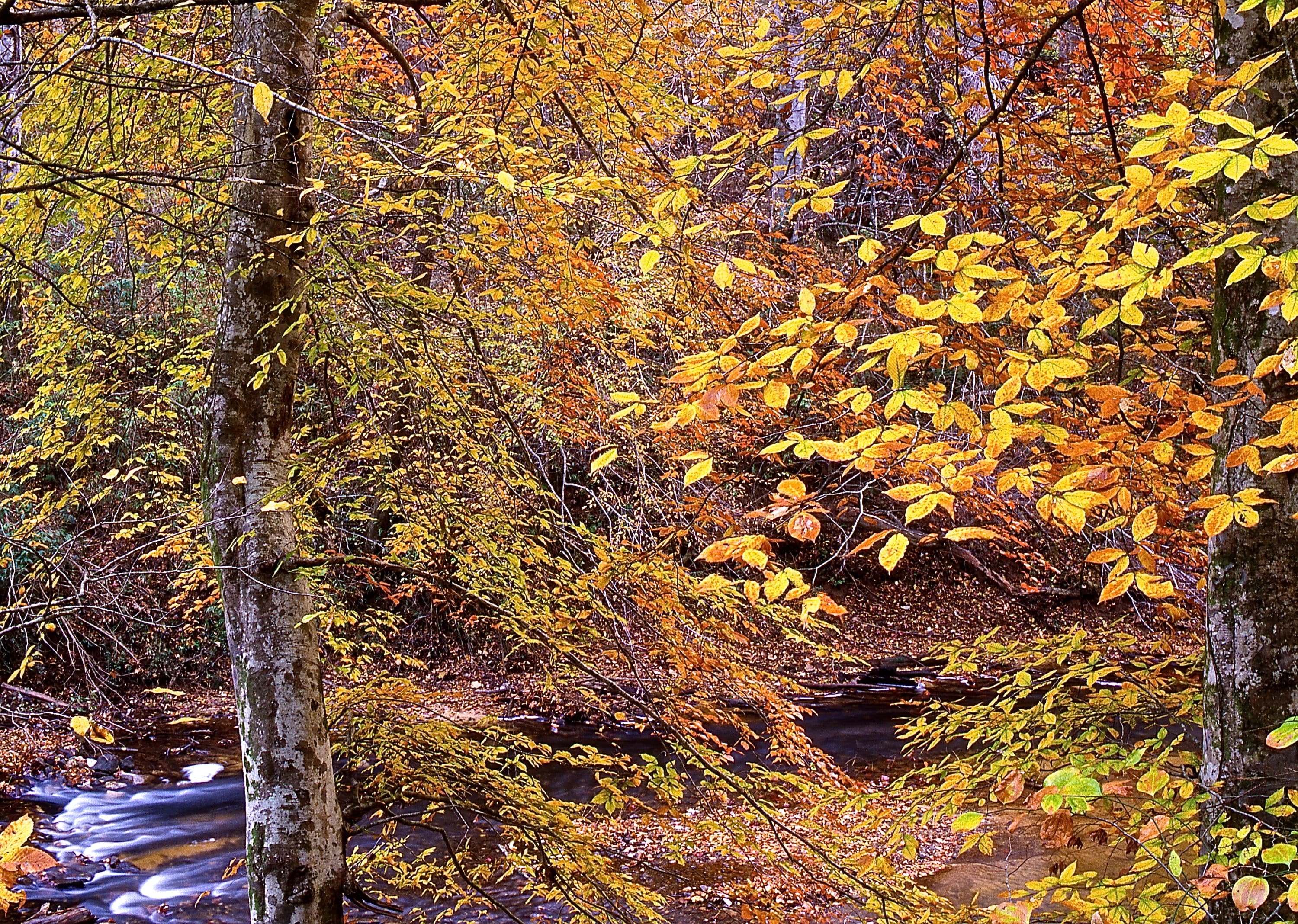
Sipsey Fork: Alabama's Only Year-Round Rainbow Trout Stream, Born Cold Below Smith Dam
Twelve miles of cold tailwater on the Sipsey Fork of the Black Warrior, stocked monthly by ADCNR with Dale Hollow rainbows — the state's one and only trout fishery, fished on fly rod and light spinning tackle.
The Sipsey Fork below Lewis Smith Dam is Alabama's only year-round rainbow trout fishery — a cold tailwater fed by Smith Dam's hypolimnetic release, stocked with Dale Hollow rainbows by ADCNR, fished twelve months.
Tailwater reach — not an impoundment (no surface-acreage figure)
Max Depth
Pool depths roughly 8-15 ft; wadeable runs 2-5 ft
Length
Roughly 12-15 miles from Smith Dam downstream to the Mulberry Fork confluence
Shoreline
N/A (river reach, not a lake shoreline)
Impounded
Not impounded — this IS the release below Lewis Smith Dam (dam entered service 1961)
River System
Sipsey Fork of the Black Warrior River
Access
Public — walk-in / wade access at Smith Dam and downstream pullouts; small-craft (drift boat, canoe, kayak) access on lower reaches
01 · Overview
The Water
The Sipsey Fork below Smith Dam is the odd one out in Alabama. Every other water in the state is a bass fishery first; this one is a trout fishery, and it's the only one. Alabama Power releases cold water out of Lewis Smith Dam year-round, and that release holds the river in the mid-50s through an Alabama August. ADCNR stocks rainbows raised at Dale Hollow National Fish Hatchery in Tennessee into the cold tailrace, and fly fishermen walk the pull-offs twelve months a year with 4-weight rods and size 18 midges. The rules are their own: five rainbows a day, no more than two rods on the water, and no culling trout from the creel — pull a fish from your stringer to swap it and you've broken the law. The reach runs twelve miles from the dam to the Mulberry Fork, and you fish it like a mountain stream in a hardwood forest. Riverside Fly Shop in Bremen anchors the scene.
“Sipsey Fork Trout Tailwater holds fish in patterns you can set your watch to. The bite isn't a secret — it's what most fishermen don't know about where the grass thins onto a hard ledge.”
Alabama Fishing Atlas Editorial
02 · Bite Windows
Solunar Forecast
Major and minor solunar windows shift daily with the moon’s transit. Fish the windows above, or check the Seasonal Playbook below for Sipsey Fork Trout Tailwater’s current pattern.
USGS pool level: Gauge 02450250 — current readings direct from USGS.
03 · The Calendar
Seasonal Playbook
Spring is the prime wade window on the Sipsey. Surface air warms into the 70s by March but Alabama Power keeps the release in the mid-50s out of Smith Dam, so the trout don't care what month it is. ADCNR's stocking truck runs monthly out of Dale Hollow, and the highest angler density sits right below the dam for the first week after a fresh stock. Size 18 Zebra Midges and size 20 WD-40s under a small Thill indicator on a 9-foot 5X leader is the default nymph rig. On cloudy days the smaller streamers move fish — a black or olive size 10 Woolly Bugger on a slow strip through the tailout of any pool. Light-tackle spin anglers throw a 1/32-ounce pink or chartreuse trout magnet, or a small Rooster Tail, through the same seams. Watch Alabama Power's generation schedule on the Riverside Fly Shop site before you wade — a sudden release at Smith turns wade-water into waist-deep current inside ten minutes.
Summer is when the Sipsey earns its reputation. While every other water in Alabama pushes into the high 80s, the release out of Smith Dam holds the tailrace in the mid-50s. Fly fishermen fish dry-dropper rigs on the riffle water at Riverside Park below the dam — a size 14 Elk Hair Caddis with a size 18 Zebra Midge or Pheasant Tail dropped eighteen inches below it. Stripers drop through the dam gates on generation and hold in the deeper pools on the lower reach below the Ryan Creek confluence — Riverside Fly Shop runs dedicated striper trips from Hwy 69 in Bremen, throwing 6- to 8-inch streamers on 8- to 10-weight rods. Afternoons get busy with swimmers and floaters upstream in the stocked reach, so early morning and late evening are the fishable windows. Two-rod and no-culling rules hold year-round on this stretch — know them before you fish.
Fall fishes shoulder-busy and pretty. Hardwood color climbs the canyon walls in the Bankhead National Forest sections, water temps stay steady on the release, and the stocking truck keeps running. Indicator nymphing a Pheasant Tail and a Hare's Ear tandem rig on 5X-6X fluoro through the Smith Dam wade water and the Ryan Creek confluence seam produces all day. Terrestrial patterns — a small Chubby Chernobyl or an ant pattern — work as the lead dry on a dry-dropper in September when grasshoppers are still bouncing. Light-spin anglers fish the same water with a 1/32-ounce marabou jig in white, olive, or pink, or a size 0 Panther Martin. Drift-boat trips through Riverside Fly Shop become more comfortable as the afternoons cool. The lower reach holds resident spotted bass and redeye-class fish on light spinning gear below the cold-water stretch. Dawn-to-mid-morning is the best window before day-tripper foot traffic builds up on the upper reach.
Winter is the Sipsey's most underrated season. Air temps drop into the 30s and 40s but Alabama Power still pushes mid-50s out of Smith Dam, so the fish stay active and the wader traffic thins out to a handful of regulars. This is classic Tennessee-Appalachian trout fishing dropped into north Alabama. Dead-drift a size 20 Zebra Midge with a size 22 RS-2 dropper under a small Thill indicator through every pool tail and seam — fish hold tight to the slowest water and refuse anything moving fast. Egg patterns in orange and pink produce on the bottom through the deeper pools. Streamer fishing is slower but a small olive or black Woolly Bugger swung slow on a sink-tip takes the occasional hold-over rainbow that's grown on a winter of midges. The two-rod rule, no-culling rule, and five-fish daily creel all hold year-round. Riverside Fly Shop keeps the Smith Dam generation schedule updated — check it before you walk in.
primitive · Houston · US Forest Service campground and day-use area on the Sipsey Fork drainage in William B. Bankhead National Forest
Campsites · Day-use picnic area · Lake / shoreline access · Forest Service-managed
Forest Service campground near the Sipsey Fork in the Bankhead NF, Winston County. Rustic campground on the trout-stream side of the reservation. Verify current open status with the Bankhead Ranger District before a trip — day-use was listed open on USFS at time of publication.
primitive · Double Springs · US Forest Service campground, boat ramp, and day-use area on Smith Lake inside Bankhead NF
Campsites · Boat ramp · Picnic areas · Hiking
Parent-lake Forest Service campground on the Smith Lake pool — useful base camp for anglers who want to fish the Smith Lake bass pool one day and the Sipsey tailwater for trout the next.
181,000-acre federal forest enclosing the Sipsey Fork drainage. Waterfalls, Sipsey Wilderness hiking trails, scenic drives, and the Forest Service campgrounds on the trout-stream side of the reservation. The primary family draw alongside the fishing.
25,986-acre federally designated wilderness inside Bankhead National Forest. Sandstone canyons, waterfalls, old-growth hemlock and hardwood, and the most celebrated hiking country in Alabama. A half-day drive and hike loop pairs well with a morning on the trout water.
Natural Bridge of Alabama
scenic
Natural Bridge, AL 35577 (Winston County)
148-foot sandstone natural bridge in Winston County — the longest natural bridge east of the Rockies. Short walking trail, rustic park. Twenty minutes from the upper Sipsey tailwater reach.
National Natural Landmark sandstone canyon known for dismalites (glowworm-class insect larvae that glow blue-green on the canyon walls at night). Guided night tours in season. About 45 minutes northwest of the Sipsey tailwater.
The 21,200-acre Alabama Power reservoir above the dam. Alabama's deepest lake and the state's signature spotted-bass fishery. Combine a morning on the trout tailwater with an afternoon on the Smith Lake pool — the two fisheries share a dam and nothing else.
Around Sipsey Fork Trout Tailwater
The Sipsey tailwater sits in a corner of the state where Walker County, Winston County, and Cullman County meet, roughly twenty minutes off US 78 out of Jasper. Jasper is the nearest full-service town on the south end — gas, ice, hardware, chain restaurants, and chain motels within a ten-minute drive of the Smith Dam parking. Bremen is the mid-reach town, built around the Riverside Fly Shop at 17027 Hwy 69 S — if you need waders, flies, or a guided day on the water, that's the anchor. Double Springs sits on the north end in Winston County and serves the west side of the Bankhead National Forest — Clear Creek Recreation Area, Houston Recreation Area, and Brushy Lake Recreation Area all run off its orbit. For anglers who want a two-day trip, split a morning of fly fishing on the Sipsey tailwater with an afternoon on the Smith Lake pool above the dam — a twenty-minute drive connects the two fisheries. Non-fishing partners get the Sipsey Wilderness, Natural Bridge of Alabama, and Dismals Canyon within an hour.
07 · Launch Day
On the Water
Boat ramps
walk-in wade access (no trailered-boat ramp) rampOpen
Smith Dam Public Walk-In Access
Jasper
Parking
spots
Fee
Free
Alabama Power public parking at the base of Lewis Smith Dam on Smith Dam Road near Jasper. Walk-in only — no boat trailer launch. Primary wade-access point for the stocked trout reach; directly below the cold-water release. Check Alabama Power generation schedule before wading.
Sipsey Fork from Lewis Smith Dam downstream to the confluence with the Mulberry Fork — ADCNR rainbow trout regulation reach: 5 rainbow trout daily creel, no more than 2 rods per angler, no culling of trout from the creel (removing and releasing a trout from your creel, live well, stringer, basket, bucket, or cooler once retained is illegal). Verify current regulations on outdooralabama.com before your trip — this is the only tailwater trout fishery in Alabama and the rules are distinct from the Smith Lake pool above.
Alabama fishing license required for all anglers 16 and older (residents and non-residents). Trout stamp not a separate Alabama requirement — the standard freshwater license covers trout fishing on the Sipsey Fork.. Always verify current rules before your trip.
Yes. The Sipsey Fork below Lewis Smith Dam is the one and only year-round trout water in Alabama. ADCNR stocks rainbows from the Dale Hollow National Fish Hatchery in Tennessee into the cold tailrace, and Alabama Power's hypolimnetic release out of Smith Dam keeps the water cold enough to hold trout twelve months a year.
Per ADCNR, the daily creel is 5 rainbow trout, you may not fish with more than 2 rods on this reach, and you may not cull trout from your creel — once a trout goes on your stringer or into your cooler, you can't release it to swap it for a bigger fish. These rules apply from Lewis Smith Dam downstream to the Mulberry Fork confluence.
No separate trout stamp is required in Alabama — an Alabama freshwater fishing license covers trout fishing on the Sipsey Fork tailwater for all anglers 16 and older, residents and non-residents. Buy licenses online through the ADCNR portal
The primary wade access is the Alabama Power public parking at the base of Lewis Smith Dam near Jasper — walk down to the river and fish the cold release water directly below the dam. Riverside Fly Shop at 17027 Hwy 69 S in Bremen is the mid-reach anchor and offers guided wade and drift-boat trips for trout, striped bass, and other species.
The upper reach right below Smith Dam is primarily a wade fishery. The middle and lower reach is drift-boat and small-craft (canoe, kayak) water — Riverside Fly Shop runs drift-boat guided trips on the tailwater for one or two anglers. Always check Alabama Power's Smith Dam generation schedule before putting in or wading.
Fishing regulations, water conditions, and seasonal patterns change. Alabama Fishing Atlas provides informational content only. Verify all regulations with the Alabama Department of Conservation and Natural Resources before fishing, keeping any fish, or launching watercraft. We are not liable for decisions made based on information published here. Full disclaimer →
Citation
Data sources
—ADCNR — Freshwater Fishing Creel and Size Limits (Rainbow Trout entry specifies Sipsey Fork from Lewis Smith Dam downstream to Mulberry Fork confluence; 5 creel, 2 rods, no culling) — https://www.outdooralabama.com/fishing/freshwater-fishing-creel-and-size-limits
—ADCNR — Rainbow Trout species page (Sipsey Fork tailwater below Smith Dam stocked with rainbows from Dale Hollow National Fish Hatchery, Tennessee) — https://www.outdooralabama.com/game-fish/rainbow-trout
—Wikipedia — Lewis Smith Lake / Lewis Smith Dam (dam entered service September 5, 1961; 264 ft max depth; Alabama Power) — https://en.wikipedia.org/wiki/Lewis_Smith_Dam
—Wikipedia — Sipsey Fork of the Black Warrior River — https://en.wikipedia.org/wiki/Sipsey_Fork_of_the_Black_Warrior_River
—USGS Water Data — Sipsey Fork Near Grayson AL, station 02450250 — https://waterdata.usgs.gov/nwis/inventory/?site_no=02450250
—Riverside Fly Shop — Full Day Guide Trip page (wade and drift-boat trout, striper, largemouth, spotted, and panfish trips; (256) 287-9582; 17027 Hwy 69 S, Bremen AL 35033) — https://riversideflyshop.com/full-day-guide-trip/
—US Forest Service — William B. Bankhead National Forest recreation (Houston Recreation Area, Brushy Lake Recreation Area, Clear Creek Recreation Area) — https://www.fs.usda.gov/r08/alabama/recreation