Big Bear Creek Reservoir: The 670-Acre Flood-Control Pool Where the Bear Creek Floatway Ends
A TVA flood-control impoundment on Bear Creek in Franklin and Marion counties, closed in 1969, thirty miles southwest of Muscle Shoals — the third of four Bear Creek Lakes, fed by the 26-mile floatway from Upper Bear Dam, and home to two BCDA campgrounds.
Big Bear Creek Reservoir is a 670-acre TVA flood-control and water-supply pool on Bear Creek at the Franklin–Marion county line in northwest Alabama — third of four Bear Creek Lakes and terminus of the 26-mile Bear Creek Floatway.
670 acres (Big Bear Reservoir per BCDA campground profiles)
Max Depth
N/A
Length
N/A
Shoreline
N/A
Impounded
1969 (TVA Bear Creek Project)
River System
Bear Creek (Tennessee River tributary)
Access
Public (BCDA permit required ages 16-65)
01 · Overview
The Water
Big Bear Creek Reservoir sits thirty miles southwest of Muscle Shoals at the Franklin–Marion county line in northwest Alabama. TVA calls it simply Bear Creek Reservoir; BCDA calls it Big Bear. Despite the name it is the smallest of the four Bear Creek Lakes at 670 acres — Cedar Creek downstream runs 4,200 and Little Bear upstream is 1,560. Closed by TVA Bear Creek Dam in 1969, it is flood-control and water-supply only, no hydro plant, fed at its upper end by the 26-mile Bear Creek Floatway draining Upper Bear Dam. Two BCDA campgrounds anchor the recreation footprint: Horseshoe Bend in Hodges (28 wooded sites, bathhouse, boat ramp, fishing pier, public beach) and Piney Point in Vina (19 sites, private white-sand beach, fishing pier). The reservoir produces largemouth, crappie, smallmouth, channel catfish, and bream per BCDA. Anglers 16-65 need both an Alabama fishing license and a BCDA permit ($8.60/day or $33.60/annual).
“Big Bear Creek Reservoir holds fish in patterns you can set your watch to. The bite isn't a secret — it's what most fishermen don't know about where the grass thins onto a hard ledge.”
Alabama Fishing Atlas Editorial
02 · Bite Windows
Solunar Forecast
Major and minor solunar windows shift daily with the moon’s transit. Fish the windows above, or check the Seasonal Playbook below for Big Bear Creek Reservoir’s current pattern.
03 · The Calendar
Seasonal Playbook
March through May is the best open-water window on Big Bear. Water climbs from the low 50s into the 70s and largemouth stage on the main-channel points off the dam and the Horseshoe Bend cove mouth before pulling into the spawning pockets up the Piney Point arm and the back of the beach coves. A suspending jerkbait on long pauses catches staging fish on clear-water points in 6-12 feet; by April a wacky Senko or a Texas-rigged lizard covers the spawning flats. Crappie push into the back of the creek arms and hang on timber in 6-10 feet — a 1/16-oz jig tipped with a minnow catches fish all day. Smallmouth pre-spawn on chunk rock near the dam; a 3/8-oz shaky head with a green-pumpkin finesse worm is the go-to. Channel cats turn on by late April when surface temps cross 65°F. BCDA permit required ages 16-65 before you launch.
June through August Memorial Day opens the floatway release cycle — Saturday 6 AM through Sunday 4 PM every weekend through Labor Day, water flushes out of Upper Bear Dam, drops the 26 miles of the floatway, and terminates in Big Bear. The current seam at the upper end of Big Bear where the floatway enters is worth fishing on release weekends — shad and bass stack on the inflow. Away from the inflow, the reservoir sets up conventional summer-lake style: largemouth pull shallow on shaded Horseshoe Bend cove banks and cabin-peninsula transitions, a green-pumpkin jig flipped to laydowns, a frog on matted grass, a buzzbait at dawn. Smallmouth and spotted bass key on main-channel rocky points and mid-lake ledges in 10-18 feet — drop-shot, small tube, Ned rig. Crappie suspend above the old creek channel in 12-18 feet; long-line small jigs to cover water, then vertical once you mark them. Channel cats hold the creek-arm mouths on cut bait. Morning bite is the window.
September through November shad migrate into the Horseshoe Bend and Piney Point arms and every gamefish follows. Largemouth and spotted bass chase shad along the main-lake shoreline and on secondary points — a lipless crankbait, a shad-pattern ChatterBait on the points, a walking bait on calm mornings over cove flats. Smallmouth slide deeper on main-lake rock as surface temps drop through the 60s — a drop-shot vertical on a point in 15-25 feet, a small swimbait parallel to the dam face, a tube on chunk-rock transitions. Crappie reload on brush and timber in 10-15 feet; long-line small jigs, then vertical on marked schools. Channel cats stay reliable on cut bait along the main channel. The floatway release cycle closes at Labor Day, so the summer inflow-current bite fades by early September. By mid-November the topwater window closes and the bite slides deeper — suspending jerkbaits and finesse baits on the main-lake rock are the late-fall answer.
December through February Big Bear runs at low pool — TVA manages all four Bear Creek reservoirs for winter flood-control storage and the lake sits several feet below summer pool through the cold months. Surface temps drop into the 40s and smallmouth and spotted bass stack on the deepest rock — the dam face, main-channel bluffs, and the rock ledges off Horseshoe Bend. A suspending jerkbait on long pauses catches sunny-afternoon feeders above 48°F; a hair jig or a blade bait fished vertical works the rock piles on cold-front days. Largemouth pull into the back of the Piney Point arm and the Horseshoe Bend cove on warming days when a two-to-three-degree surface bump fires up the shallows — a slow-rolled spinnerbait, a jig-and-pig on wood. Crappie hold deep on brush in 18-25 feet; vertical minnows and tiny jigs catch them. Check current TVA lake levels on tva.com/environment/lake-levels/bear-creek before every trip — winter pool changes ramp usability and exposes rock on main-lake points.
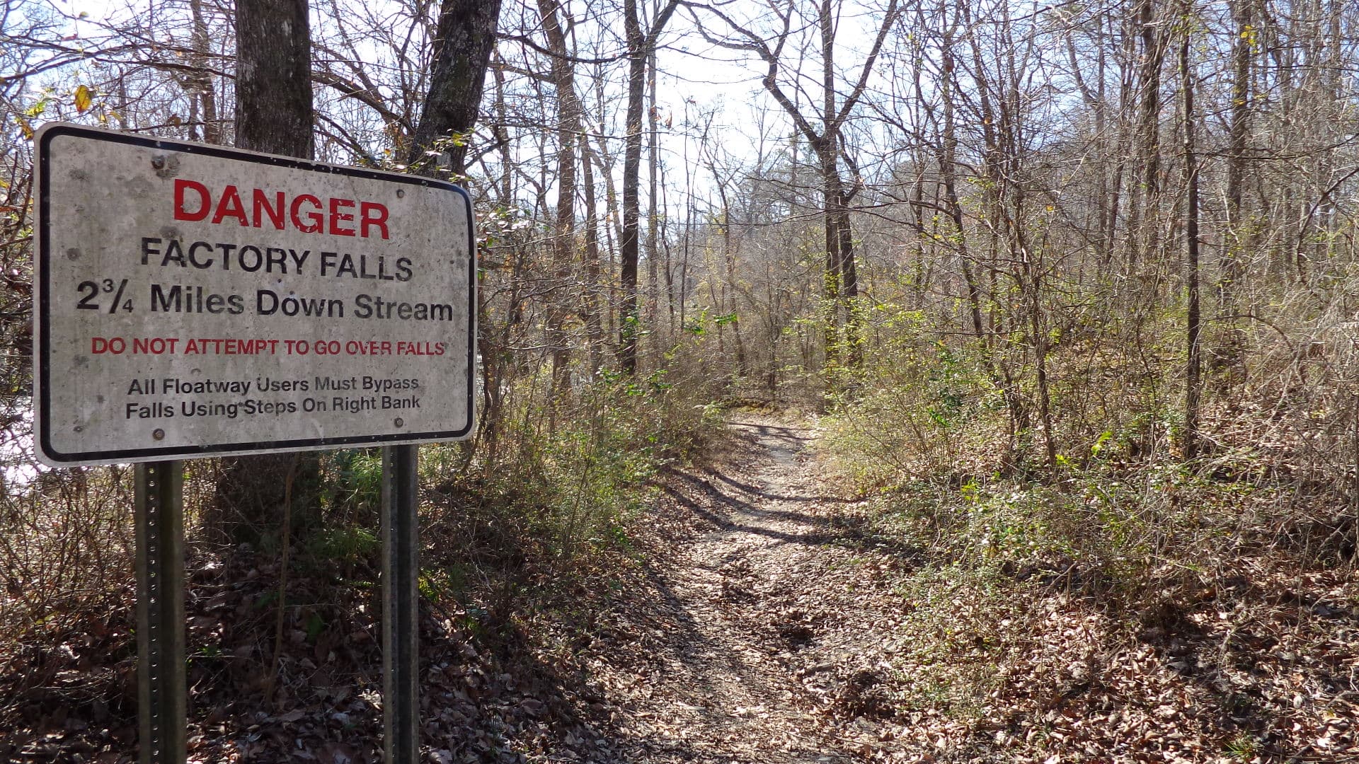
26-mile Class I canoe and kayak run beginning below Upper Bear Creek Dam upstream and terminating at Big Bear Creek Reservoir. TVA scheduled recreational releases run Saturday 6 AM through Sunday 4 PM Memorial Day through Labor Day. Upper Factory Falls (Class IV) and Lower Factory Falls (Class VI) are mandatory-portage hazards on the floatway.
Privately owned 85-acre nature conservatory in Phil Campbell, designated a National Natural Landmark in 1975 by the National Park Service. Home of the Dismalites (bioluminescent fly larvae) — night tours Friday and Saturday in season. About 25 minutes east of the Horseshoe Bend ramp via AL-172 and AL-237.
34-mile float below Bear Creek Dam running down the lower Bear Creek to Pickwick Landing Dam on the Tennessee River — a more leisurely counterpart to the Upper Bear floatway above the reservoir per TVA.
Around Big Bear Creek Reservoir
Big Bear Creek Reservoir sits at the Franklin–Marion county line in the northwest corner of Alabama, with Hodges (Franklin County) on the east and Vina (Franklin County) on the west. Hodges and Vina are both tiny crossroads towns — Hodges has about 265 residents and Vina about 325 — so expect bait, ice, and fuel at the BCDA campground stores rather than lakeside restaurants. The closest full-service towns are Russellville (Franklin County seat, roughly twenty minutes north via AL-187 and US-43) and Red Bay (seven miles northwest of Vina). Phil Campbell sits east of the reservoir and is the closest town to Dismals Canyon. There are no marinas or lakefront restaurants on Big Bear — this is a secluded flood-control pool where the recreation footprint is the two BCDA campgrounds (Horseshoe Bend and Piney Point), the two concrete ramps, and the floatway inflow at the upper end. Lodging on the reservoir itself is limited to the campground tent and RV sites; the eleven BCDA resort cabins on Little Bear at Elliot Branch sit about fifteen minutes away if you need a cabin rental.
07 · Launch Day
On the Water
Boat ramps
concrete rampOpen
Horseshoe Bend Boat Ramp
Hodges
Parking
spots
Fee
BCDA user's permit (ages 16-65)
2355 Horseshoe Bend Rd, Hodges, AL 35571 (Franklin County). BCDA ramp on Big Bear Reservoir at the 28-site Horseshoe Bend Campground — bathhouse, fishing pier, and public beach on site. Camp manager Ricky Parrish at (205) 412-2430. Coordinates ~34.3844, -87.9679.
2696 Highway 37, Vina, AL 35593 (Franklin County). BCDA ramp on Big Bear Reservoir at the 19-site Piney Point Campground — bathhouse, fishing pier, and private white-sand beach with swimming pier on site. Camp phone (256) 815-6060.
BCDA public ramp on Big Bear Reservoir per the Bear Creek Development Authority boat-ramps page, which groups Scott's Landing with Piney Point and Horseshoe Bend on Big Bear. No posted street address on the BCDA site; call the BCDA office at (256) 332-4392 (1111 Highway 88, Hodges) for directions before your trip.
10 black bass daily aggregate (largemouth / smallmouth / spotted / Alabama) — Alabama statewide limit. No more than 5 of the 10 may be smallmouth. · No statewide minimum length on largemouth, smallmouth, or spotted bass in Alabama general public waters — Big Bear Creek Reservoir has no published special black-bass size regulation. Verify current ADCNR regulations before keeping fish.
Crappie
30 per day (statewide). · 9-inch minimum (statewide).
Striped/White Bass
Big Bear Creek Reservoir is part of the TVA Bear Creek Project, managed for recreation by the Bear Creek Development Authority (BCDA). Anglers ages 16-65 must purchase a BCDA user's permit in addition to an Alabama fishing license. Bear Creek Dam is operated by TVA for flood control and water supply — it is not a hydroelectric facility. Memorial Day through Labor Day, TVA runs scheduled recreational releases from Upper Bear Creek Dam each Saturday 6 AM through Sunday 4 PM to feed the 26-mile Bear Creek Floatway; the floatway terminates at Big Bear Creek Reservoir. Below Bear Creek Dam the Lower Bear Creek Canoe Trail runs 34 miles to Pickwick Landing Dam on the Tennessee River. Verify current ADCNR regulations at outdooralabama.com and current TVA operating conditions at tva.com/environment/lake-levels/bear-creek before your trip.
Alabama fishing license required for all anglers 16 and older (residents and non-residents). In addition, the Bear Creek Development Authority requires a user's permit for every person ages 16-65 using BCDA lakes and facilities — $8.60/day, $12.60/three-day, or $33.60/annual per current BCDA pricing (bearcreeklakes.com/permits). Annual permits run October 1 through September 30. Lifetime permits are sold in-person at the BCDA office at 1111 Highway 88, Hodges.. Always verify current rules before your trip.
Bear Creek Reservoir — BCDA calls it Big Bear to distinguish it from the three sister pools — sits in Franklin and Marion counties in the northwest corner of Alabama, thirty miles southwest of Muscle Shoals per TVA. The Horseshoe Bend Campground access is at 2355 Horseshoe Bend Rd in Hodges, and the Piney Point Campground access is at 2696 Highway 37 in Vina — both in Franklin County. The reservoir is the third of four in the TVA Bear Creek Project, with Cedar Creek downstream, and Little Bear and Upper Bear upstream.
670 surface acres per Bear Creek Development Authority's Horseshoe Bend Campground profile — the smallest of the four Bear Creek Lakes by surface area (Cedar Creek downstream runs 4,200 acres, Little Bear upstream is 1,560, and Upper Bear is a long 14-mile headwater pool). Bear Creek Dam was closed by TVA in 1969 for flood control and water supply — no hydroelectric generation, flood-control releases only.
Both an Alabama fishing license (anyone 16 or older, any residency) and a Bear Creek Development Authority user's permit for anyone ages 16 through 65, priced at $8-$9 per day or $33-$34 per year per current BCDA pricing. The Alabama license is available from ADCNR at Outdoor Alabama; the BCDA permit is available online via bearcreeklakes permits page, at the campgrounds, or in person at the BCDA office at 1111 Highway 88 in Hodges (lifetime permits in-person only). Anglers with a legal Alabama disability license can use that in place of a BCDA permit per BCDA policy.
Two BCDA public ramps and two BCDA campgrounds: Horseshoe Bend in Hodges (28 wooded campsites, bathhouse, fishing pier, public beach) and Piney Point in Vina (19 campsites, bathhouse, fishing pier, private white-sand beach with swimming pier). Both ramps are concrete with pier access and connect to the campground stores, which stock live bait. BCDA also operates a public-access ramp network on the sister Bear Creek reservoirs upstream and downstream — Upper Bear (Quarter Creek, Mon-Dye, Twin Forks), Little Bear (Elliot Branch, Williams Hollow, McAfee), and Cedar Creek downstream (Slickrock and others).
The 26-mile Bear Creek Floatway begins below Upper Bear Creek Dam upstream and terminates at Big Bear Creek Reservoir — per TVA, "the Bear Creek Floatway flows into Bear Creek Reservoir." Scheduled recreational releases from Upper Bear Dam run Saturday 6 AM through Sunday 4 PM Memorial Day through Labor Day, bringing current and bait into the upper end of Big Bear on release weekends. Below Bear Creek Dam at the south end of Big Bear, the Lower Bear Creek Canoe Trail provides a more leisurely 34-mile float down to Pickwick Landing Dam on the Tennessee River.
Fishing regulations, water conditions, and seasonal patterns change. Alabama Fishing Atlas provides informational content only. Verify all regulations with the Alabama Department of Conservation and Natural Resources before fishing, keeping any fish, or launching watercraft. We are not liable for decisions made based on information published here. Full disclaimer →
Citation
Data sources
—Tennessee Valley Authority — Bear Creek Reservoir lake levels and operating information (https://www.tva.com/environment/lake-levels/bear-creek)
—Tennessee Valley Authority — Bear Creek dam overview (https://www.tva.com/energy/our-power-system/hydroelectric/Bear-Creek)
—Tennessee Valley Authority — TVA Lake Info Bear Creek Reservoir (https://lakeinfo.tva.gov/web/sites/bearcreek.htm)
—Bear Creek Development Authority — Bear Creek Lakes homepage (https://bearcreeklakes.com/)
—Bear Creek Development Authority — Boat Ramps (https://bearcreeklakes.com/boat-ramps/)
—Bear Creek Development Authority — Horseshoe Bend Campground (https://bearcreeklakes.com/horseshoe-bend/)
—Bear Creek Development Authority — Piney Point Campground (https://bearcreeklakes.com/piney-point/)
—Bear Creek Development Authority — Permits (https://bearcreeklakes.com/permits/)
—Wikipedia — Bear Creek (Tennessee River tributary) (https://en.wikipedia.org/wiki/Bear_Creek_(Tennessee_River_tributary))
—Alabama Department of Conservation and Natural Resources — Freshwater Fishing Creel and Size Limits (https://www.outdooralabama.com/fishing/freshwater-fishing-creel-and-size-limits)
—Alabama Department of Conservation and Natural Resources — Outdoor Alabama (https://www.outdooralabama.com/fishing)